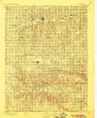
1896 Map of Plainville
USGS Topo · Published 1904About this map
Plainville and Stockton anchor this late nineteenth-century landscape, serving as primary hubs for the surrounding agricultural townships of Rooks and Ellis counties. The development of the region is clearly etched by the competing paths of the Union Pacific RR through the southern plains and the Missouri Pacific RR following the South Fork Solomon River valley to the north. These steel corridors connected isolated settlements like Zurich, Webster, and Natoma to wider markets, facilitating the transition from frontier territory to a structured rail-and-river economy.
Find a feature on this map
55 named features on this map. Tap any name to fly to it.
Don’t see what you’re looking for? This feature index may not catch every label — zoom into the map to look around manually.
Map Details
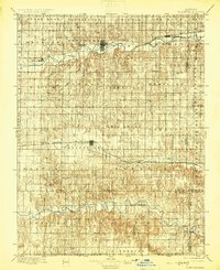
Editions of this 1896 Plainville Map
3 editions found
Other maps of this area

1893 · Ellis
USGS Topo · 1:125,000

1893 · Smith Center
USGS Topo · 1:125,000

1893 · Norton
USGS Topo · 1:125,000

1893 · Phillipsburg
USGS Topo · 1:125,000

1893 · Hill
USGS Topo · 1:125,000

1896 · Osborne
USGS Topo · 1:125,000

1896 · Russell
USGS Topo · 1:125,000

1896 · Hays
USGS Topo · 1:125,000

1896 · Plainville
USGS Topo · 1:125,000

1952 · Webster Dam
USGS Topo · 1:24,000