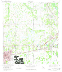
1975 Map of Plant City East
USGS Topo · Published 1977About this map
The eastern edge of Plant City anchors this 1970s survey, showing a landscape defined by the intersection of industrial growth and rural wetlands. Extensive strip mines dominate the southern portion of the map, revealing the scale of phosphate extraction near Youmans. Transport corridors like the Seaboard Coast Line and Frontage Road cut through the terrain, connecting established settlements like Kathleen and Winston to the burgeoning urban center.
Find a feature on this map
52 named features on this map. Tap any name to fly to it.
Don’t see what you’re looking for? This feature index may not catch every label — zoom into the map to look around manually.
Map Details
Editions of this 1975 Plant City East Map
3 editions found
Other maps of this area

1944 · Plant City
USGS Topo · 1:31,680

1944 · Providence
USGS Topo · 1:31,680

1944 · Lakeland
USGS Topo · 1:31,680

1944 · Antioch
USGS Topo · 1:31,680

1944 · Socrum
USGS Topo · 1:31,680

1947 · Zephyrhills
USGS Topo · 1:24,000

1949 · Mulberry
USGS Topo · 1:24,000

1950 · Mulberry
USGS Topo · 1:24,000

1955 · Nichols
USGS Topo · 1:24,000

1955 · Dover
USGS Topo · 1:24,000