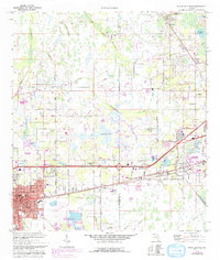
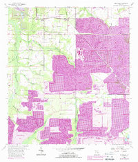
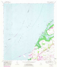
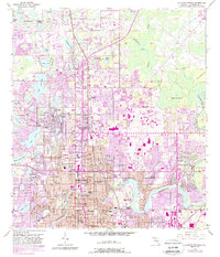
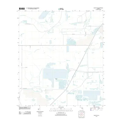
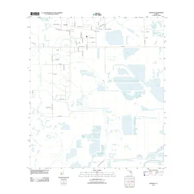
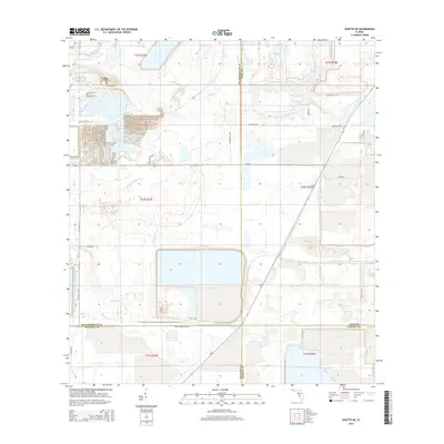
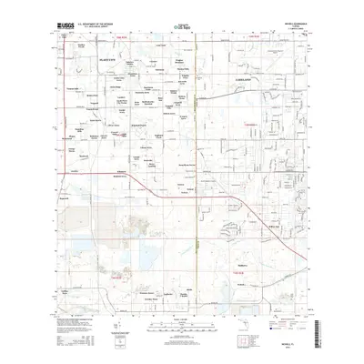
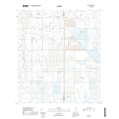
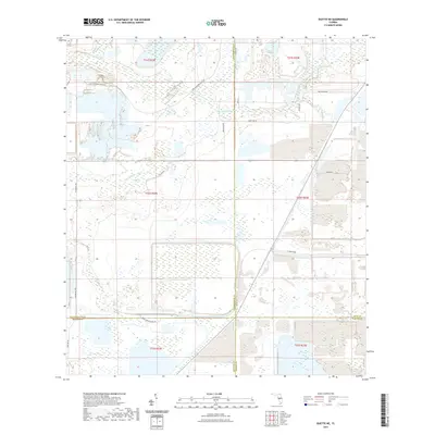
1975 Map of Plant City East
USGS Topo · Published 1993About this map
The agricultural and industrial transition of eastern Plant City is recorded here, where citrus groves and neighborhoods met the expanding phosphate industry. Along the southern corridor, the CSX rail line connects small settlements like Youmans and Winston, while the city center features established landmarks including Oaklawn Cemetery and Marshall High School. To the north, the landscape remains more open, defined by the winding course of Itchepackesassa Creek and the broad expanse of Wiggins Prairie.
Find a feature on this map
43 named features on this map. Tap any name to fly to it.
Don’t see what you’re looking for? This feature index may not catch every label — zoom into the map to look around manually.
Map Details
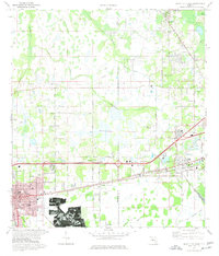
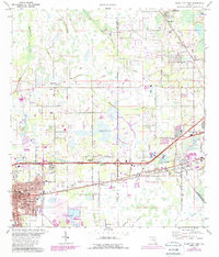
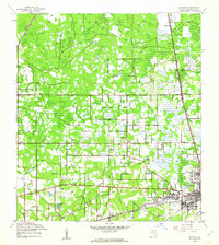
Editions of this 1975 Plant City East Map
3 editions found
Historical Maps of Lakeland Through Time
91 maps found

1942 Cockroach Bay
Hillsborough County, FL

1943 Gandy Bridge
Hillsborough County, FL

1943 Port Tampa
Hillsborough County, FL
1944 Antioch
Hillsborough County, FL
1944 Egmont Key
Hillsborough County, FL

1944 Sulphur Springs
Hillsborough County, FL

1945 Cockroach Bay
Hillsborough County, FL

1945 Gadsden Point
Hillsborough County, FL

1945 Sulphur Springs
Hillsborough County, FL

1947 Cockroach Bay
Hillsborough County, FL

1947 Gadsden Point
Hillsborough County, FL

1947 Gandy Bridge
Hillsborough County, FL
1947 Port Tampa
Hillsborough County, FL

1949 Sulphur Springs
Hillsborough County, FL
1955 Keysville
Hillsborough County, FL
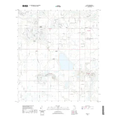
1955 Lithia
Hillsborough County, FL

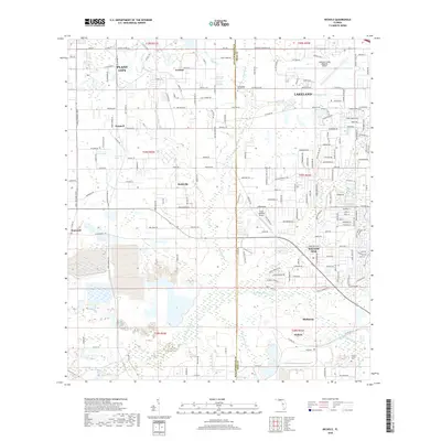
1955 Nichols
Hillsborough County, FL
1956 Cockroach Bay
Hillsborough County, FL
1956 Duette NE
Hillsborough County, FL
1956 Fort Lonesome
Hillsborough County, FL

1956 Gandy Bridge
Hillsborough County, FL
1956 Port Tampa
Hillsborough County, FL
1956 Sulphur Springs
Hillsborough County, FL
1964 Egmont Key
Hillsborough County, FL
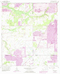
1975 Plant City East
Hillsborough County, FL
1975 Plant City West
Hillsborough County, FL

1981 St Petersburg
Hillsborough County, FL

1994 Plant City East
Hillsborough County, FL

1995 Sulphur Springs
Hillsborough County, FL

1998 Gandy Bridge
Hillsborough County, FL
2012 Cockroach Bay
Hillsborough County, FL
2012 Duette NE
Hillsborough County, FL
2012 Egmont Key
Hillsborough County, FL
2012 Fort Lonesome
Hillsborough County, FL
2012 Gandy Bridge
Hillsborough County, FL
2012 Keysville
Hillsborough County, FL
2012 Lithia
Hillsborough County, FL
2012 Nichols
Hillsborough County, FL

2012 Plant City East
Hillsborough County, FL

2012 Plant City West
Hillsborough County, FL

2012 Port Tampa
Hillsborough County, FL

2012 Sulphur Springs
Hillsborough County, FL
2015 Cockroach Bay
Hillsborough County, FL
2015 Duette NE
Hillsborough County, FL
2015 Egmont Key
Hillsborough County, FL

2015 Fort Lonesome
Hillsborough County, FL

2015 Gandy Bridge
Hillsborough County, FL
2015 Keysville
Hillsborough County, FL
2015 Lithia
Hillsborough County, FL
2015 Nichols
Hillsborough County, FL

2015 Plant City East
Hillsborough County, FL

2015 Plant City West
Hillsborough County, FL

2015 Port Tampa
Hillsborough County, FL

2015 Sulphur Springs
Hillsborough County, FL

2018 Cockroach Bay
Hillsborough County, FL
2018 Duette NE
Hillsborough County, FL
2018 Egmont Key
Hillsborough County, FL

2018 Fort Lonesome
Hillsborough County, FL
2018 Gandy Bridge
Hillsborough County, FL
2018 Keysville
Hillsborough County, FL
2018 Lithia
Hillsborough County, FL
2018 Nichols
Hillsborough County, FL

2018 Plant City East
Hillsborough County, FL

2018 Plant City West
Hillsborough County, FL

2018 Port Tampa
Hillsborough County, FL

2018 Sulphur Springs
Hillsborough County, FL
2021 Cockroach Bay
Hillsborough County, FL
2021 Duette NE
Hillsborough County, FL

2021 Egmont Key
Hillsborough County, FL

2021 Fort Lonesome
Hillsborough County, FL
2021 Gandy Bridge
Hillsborough County, FL

2021 Keysville
Hillsborough County, FL
2021 Lithia
Hillsborough County, FL
2021 Nichols
Hillsborough County, FL

2021 Plant City East
Hillsborough County, FL

2021 Plant City West
Hillsborough County, FL

2021 Port Tampa
Hillsborough County, FL

2021 Sulphur Springs
Hillsborough County, FL
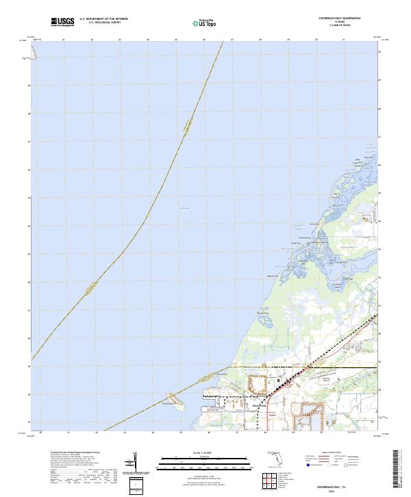
2024 Cockroach Bay
Hillsborough County, FL
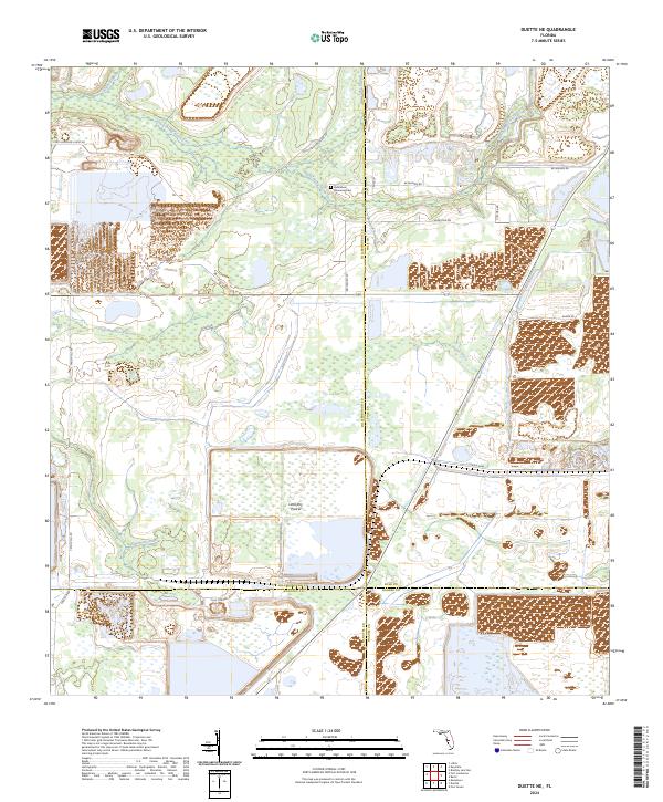
2024 Duette NE
Hillsborough County, FL
2024 Egmont Key
Hillsborough County, FL
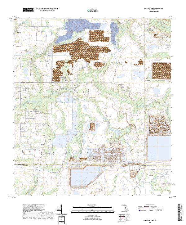
2024 Fort Lonesome
Hillsborough County, FL

2024 Gandy Bridge
Hillsborough County, FL
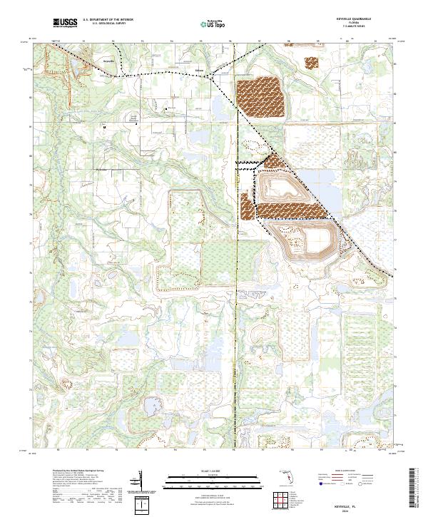
2024 Keysville
Hillsborough County, FL

2024 Lithia
Hillsborough County, FL
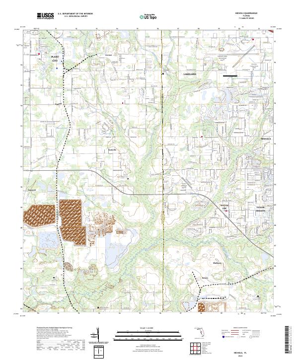
2024 Nichols
Hillsborough County, FL
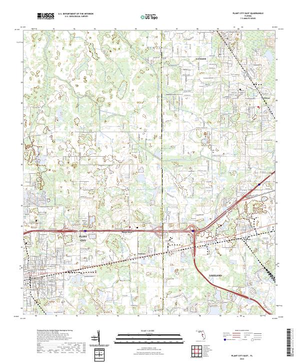
2024 Plant City East
Hillsborough County, FL
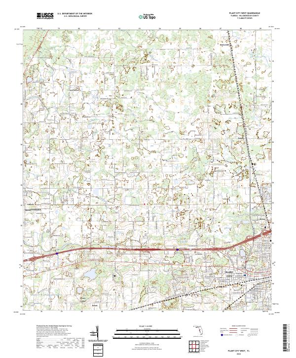
2024 Plant City West
Hillsborough County, FL

2024 Port Tampa
Hillsborough County, FL

2024 Sulphur Springs
Hillsborough County, FL
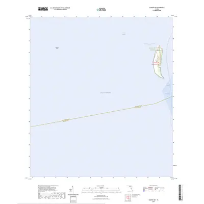
2025 Egmont Key
Hillsborough County, FL