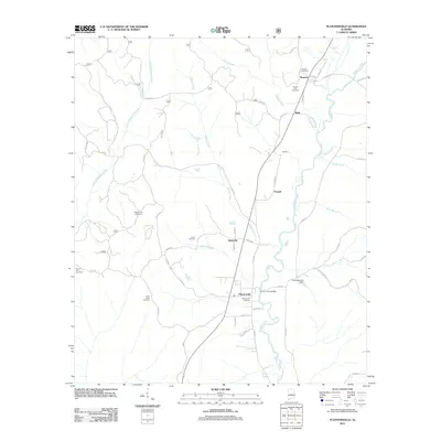
2011 Map of Plantersville
USGS Topo · Published 2011About this map
Mulberry Creek and its many tributaries, including Boggles Creek and Ward Creek, define the landscape of this portion of Chilton County. Small settlements are concentrated along the primary north-south transit corridor, with Stanton and Dixie situated in the north, leading down toward Riderville and the larger center at Plantersville. The distribution of family and community landmarks, such as Valley Creek Cemetery and Spring Hill Cemetery, suggests a deeply rooted rural society tied to the land and its waterways.
Find a feature on this map
56 named features on this map. Tap any name to fly to it.
Don’t see what you’re looking for? This feature index may not catch every label — zoom into the map to look around manually.
Map Details
Editions of this 2011 Plantersville Map
This is the sole edition of this map. No revisions or reprints were ever made.
Other maps of this area

1891 · Clanton
USGS Topo · 1:125,000

1953 · Montgomery
USGS Topo · 1:250,000

1956 · Montgomery
USGS Topo · 1:250,000

1957 · Montgomery
USGS Topo · 1:250,000

1959 · Plantersville
USGS Topo · 1:62,500

1959 · Summerfield
USGS Topo · 1:62,500
1971 · Maplesville East
USGS Topo · 1:24,000

1971 · Maplesville West
USGS Topo · 1:24,000

1975 · Plantersville SE
USGS Topo · 1:24,000
1975 · Plantersville SW
USGS Topo · 1:24,000