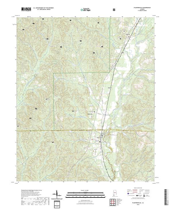
2024 Map of Plantersville
USGS Topo · Published 2024About this map
Mulberry Creek winds through the heart of this central Alabama landscape, marking the convergence of Chilton, Dallas, and Autauga counties. The settlement of Plantersville serves as a local hub, anchored by the Plantersville Methodist Church Cem and Plantersville Christian Cem. The terrain is characterized by a dense network of tributaries including Little Oakmulgee Creek, Boggles Creek, and Harris Branch, which carve through the western reaches of the Talladega National Forest.
Find a feature on this map
66 named features on this map. Tap any name to fly to it.
Don’t see what you’re looking for? This feature index may not catch every label — zoom into the map to look around manually.
Map Details
Editions of this 2024 Plantersville Map
This is the sole edition of this map. No revisions or reprints were ever made.
Other maps of this area

1891 · Clanton
USGS Topo · 1:125,000

1953 · Montgomery
USGS Topo · 1:250,000

1956 · Montgomery
USGS Topo · 1:250,000

1957 · Montgomery
USGS Topo · 1:250,000

1959 · Plantersville
USGS Topo · 1:62,500

1959 · Summerfield
USGS Topo · 1:62,500
1971 · Maplesville East
USGS Topo · 1:24,000

1971 · Maplesville West
USGS Topo · 1:24,000

1975 · Plantersville SE
USGS Topo · 1:24,000
1975 · Plantersville SW
USGS Topo · 1:24,000