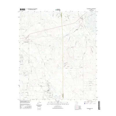
2016 Map of Plantersville
USGS Topo · Published 2016About this map
Plantersville and the surrounding woodlands of southeast Texas are defined by a network of creeks and small settlements straddling the Grimes and Montgomery county line. This 2016 survey documents a landscape of mixed rural residential growth and traditional crossroads, including the unique enclave of Todd Mission and the neighboring community of Todd. The terrain is drained by numerous waterways such as Caney Cr, Hurricane Cr, and Mill Cr, which cut through the sandy soils of the region.
Find a feature on this map
111 named features on this map. Tap any name to fly to it.
Don’t see what you’re looking for? This feature index may not catch every label — zoom into the map to look around manually.
Map Details
Editions of this 2016 Plantersville Map
This is the sole edition of this map. No revisions or reprints were ever made.
Other maps of this area

1954 · Beaumont
USGS Topo · 1:250,000

1957 · Beaumont
USGS Topo · 1:250,000

1959 · Montgomery
USGS Topo · 1:24,000

1960 · Waller NW
USGS Topo · 1:24,000

1961 · Anderson
USGS Topo · 1:24,000

1961 · Stoneham
USGS Topo · 1:24,000

1962 · Keenan
USGS Topo · 1:24,000

1962 · Dacus
USGS Topo · 1:24,000

1962 · Plantersville
USGS Topo · 1:24,000
1962 · Magnolia East
USGS Topo · 1:24,000