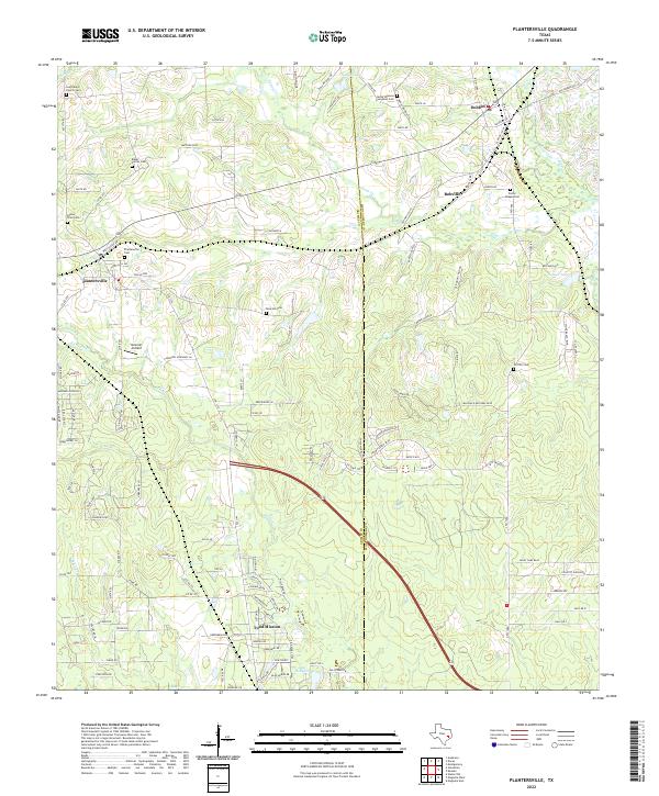
2022 Map of Plantersville
USGS Topo · Published 2022About this map
Plantersville and the surrounding piney woods of the Grimes and Montgomery county line are characterized by a network of historic family and church burial grounds. Notable sites for genealogical research include the Saint Marys Church Cem, Baker Family Cem, and Jacob Shannon Evergreen Cem. The landscape is defined by the winding paths of Caney Cr and Mill Cr, which dictate the rural road patterns and settlement boundaries. In the south, Todd Mission sits near Lake Hollyhill, while the eastern portion of the map shows the communities of Dobbin and Bobville. Small aviation history is preserved at Hammer Airfield, situated amidst the undulating terrain between Hurricane Cr and Kickapoo Cr. The map provides a clear record of modern land divisions and rural residential growth alongside traditional Texas landmarks.
Find a feature on this map
128 named features on this map. Tap any name to fly to it.
Don’t see what you’re looking for? This feature index may not catch every label — zoom into the map to look around manually.
Map Details
Editions of this 2022 Plantersville Map
This is the sole edition of this map. No revisions or reprints were ever made.
Other maps of this area

1954 · Beaumont
USGS Topo · 1:250,000

1957 · Beaumont
USGS Topo · 1:250,000

1959 · Montgomery
USGS Topo · 1:24,000

1960 · Waller NW
USGS Topo · 1:24,000

1961 · Anderson
USGS Topo · 1:24,000

1961 · Stoneham
USGS Topo · 1:24,000

1962 · Keenan
USGS Topo · 1:24,000

1962 · Dacus
USGS Topo · 1:24,000

1962 · Plantersville
USGS Topo · 1:24,000
1962 · Magnolia East
USGS Topo · 1:24,000