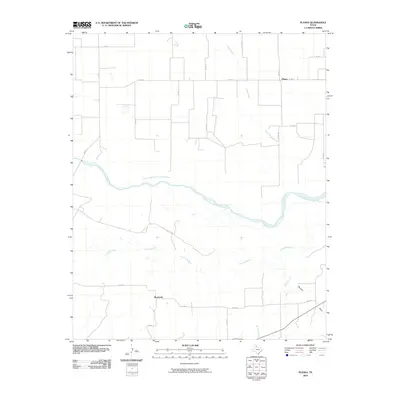
2010 Map of Plaska
USGS Topo · Published 2010About this map
The confluence of high plains ranching and river drainage defines this Hall County landscape in the early 21st century. The map is anchored by the settlement of Plaska, situated north of the expansive Prairie Dog Town Fork Red River. This river system, along with the Little Red River to the south, creates a distinct network of seasonal watercourses and draws, including Oaks Creek and Bullard Creek, that cut through the local topography. A grid of county roads and farm-to-market routes, such as FM 657 and FM 2472, provides access to the agricultural parcels surrounding Buzzard Draw. The survey reveals a sparsely populated region where natural water boundaries dictated the layout of early transportation and property lines.
Find a feature on this map
20 named features on this map. Tap any name to fly to it.
Don’t see what you’re looking for? This feature index may not catch every label — zoom into the map to look around manually.
Map Details
Editions of this 2010 Plaska Map
This is the sole edition of this map. No revisions or reprints were ever made.
Other maps of this area

1954 · Plainview
USGS Topo · 1:250,000

1958 · Plainview
USGS Topo · 1:250,000

1960 · Brice
USGS Topo · 1:62,500

1961 · Memphis
USGS Topo · 1:62,500

1967 · Tampico Siding
USGS Topo · 1:24,000

1967 · Badger Nest Tank
USGS Topo · 1:24,000

1967 · Blue Tank Canyon
USGS Topo · 1:24,000

1976 · Brice SE
USGS Topo · 1:24,000

1976 · Memphis NW
USGS Topo · 1:24,000
1976 · Brice NE
USGS Topo · 1:24,000