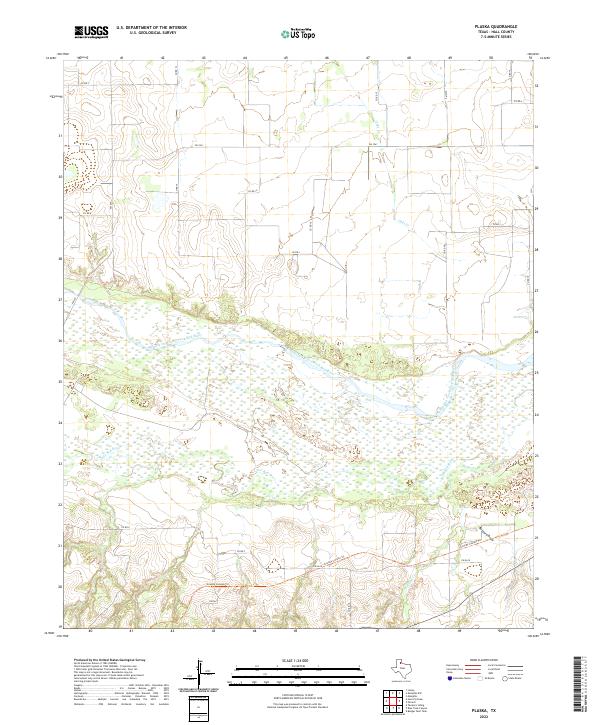
2022 Map of Plaska
USGS Topo · Published 2022About this map
The braided channels of the Prairie Dog Town Fork Red River dominate this Hall County landscape, illustrating a classic Texas Panhandle river system with wide, sandy beds and intermittent water flows. To the south, the Little Red River and Bullard Cr converge, carving through the local topography before joining the larger fork. The map reveals a sparsely populated ranching or agricultural environment where movement is dictated by a grid of farm-to-market roads and county lines, such as FM 1041 and FM 2639. Of particular interest to those studying the natural contours of the region is the Grundy Canyon Trl, which navigates the broken terrain near Buzzard Draw in the southeast. This document captures the modern state of these seasonal waterways and the enduring infrastructure of rural West Texas.
Find a feature on this map
21 named features on this map. Tap any name to fly to it.
Don’t see what you’re looking for? This feature index may not catch every label — zoom into the map to look around manually.
Map Details
Editions of this 2022 Plaska Map
This is the sole edition of this map. No revisions or reprints were ever made.
Other maps of this area

1954 · Plainview
USGS Topo · 1:250,000

1958 · Plainview
USGS Topo · 1:250,000

1960 · Brice
USGS Topo · 1:62,500

1961 · Memphis
USGS Topo · 1:62,500

1967 · Tampico Siding
USGS Topo · 1:24,000

1967 · Badger Nest Tank
USGS Topo · 1:24,000

1967 · Blue Tank Canyon
USGS Topo · 1:24,000

1976 · Brice SE
USGS Topo · 1:24,000

1976 · Memphis NW
USGS Topo · 1:24,000
1976 · Brice NE
USGS Topo · 1:24,000