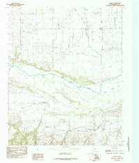
1985 Map of Plaska
USGS Topo · Published 1985About this map
Plaska serves as the primary landmark in this Hall County landscape, situated near the northern edge of a complex drainage system. The geography is dominated by the wide, sandy corridor of the Prairie Dog Town Fork Red River, which cuts a broad path across the center of the sheet. This river system creates a distinct environment characterized by braided channels and features like Goat Island, highlighting the alluvial nature of the Texas Panhandle's watercourses during the mid-1980s.
Find a feature on this map
8 named features on this map. Tap any name to fly to it.
Don’t see what you’re looking for? This feature index may not catch every label — zoom into the map to look around manually.
Map Details
Editions of this 1985 Plaska Map
This is the sole edition of this map. No revisions or reprints were ever made.
Other maps of this area

1954 · Plainview
USGS Topo · 1:250,000

1958 · Plainview
USGS Topo · 1:250,000

1960 · Brice
USGS Topo · 1:62,500

1961 · Memphis
USGS Topo · 1:62,500

1967 · Tampico Siding
USGS Topo · 1:24,000

1967 · Badger Nest Tank
USGS Topo · 1:24,000

1967 · Blue Tank Canyon
USGS Topo · 1:24,000

1976 · Brice SE
USGS Topo · 1:24,000

1976 · Memphis NW
USGS Topo · 1:24,000
1976 · Brice NE
USGS Topo · 1:24,000