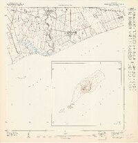
1947 Map of Playa De Ponce NE
USGS Topo · Published 1947About this map
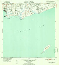
Sugar production and coastal navigation define this mid-century survey of the Caribbean shoreline where the Municipio de Ponce meets the Municipio de Juana Diaz. The landscape is dominated by large agricultural estates and industrial hubs, most notably Central Fortuna and Central Boca Chica, which are surrounded by a network of canals and irrigation ditches. Rural life centers on named haciendas like Hacienda Unión and Hacienda Serrano, connected by roads and rail lines that once moved cane to the mills. Off the coast, the topography provides a striking contrast with the detailed mapping of Isla de Muertos, featuring the prominent Cerro Morrillo and a coastal Faro. This 1940s record documents the established agricultural patterns and drainage systems along the Río Jacaguas before significant late-century modernization.
Find a feature on this map
19 named features on this map. Tap any name to fly to it.
Don’t see what you’re looking for? This feature index may not catch every label — zoom into the map to look around manually.
Map Details
Editions of this 1947 Playa De Ponce NE Map
This is the sole edition of this map. No revisions or reprints were ever made.
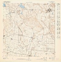
Other maps of this area

1944 · Santa Isabel
USGS Topo · 1:30,000

1945 · Playa De Ponce
USGS Topo · 1:30,000

1945 · Ponce
USGS Topo · 1:30,000

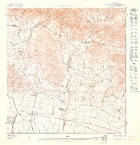
1945 · Rio Descalabrado
USGS Topo · 1:30,000

1947 · Ponce SO
USGS Topo · 1:10,000
1947 · Ponce SE
USGS Topo · 1:10,000
1947 · Santa Isabel NO
USGS Topo · 1:10,000
1947 · Rio Descalabrado SO
USGS Topo · 1:10,000

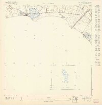
1947 · Playa De Ponce NO
USGS Topo · 1:10,000
1952 · Playa De Ponce
USGS Topo · 1:30,000