1947 Map of Ponce SE
USGS Topo · Published 1947About this map
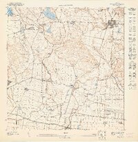
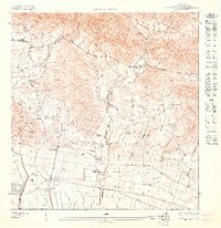
Agricultural haciendas and organized settlements define the south-central coastal plain of Puerto Rico as it appeared in the late 1940s. The town of Juana Diaz serves as the regional anchor, while the Carretera Central and the Ponce and Guayama RR provide critical transit links between the mountain foothills and the Caribbean coast. The landscape is intensely managed, characterized by numerous agricultural estates such as Hacienda Luciana, Hacienda Ponceña, and Hacienda Fé, which likely centered on the region's sugar production. Several satellite communities, including Coto Laurel and Poblado Jacaguas, are situated along the river valleys of the Río Jacaguas and Río Inabón. Near the coast, an expansive U.S. Military Reservation occupies the flatlands south of Hacienda Potala, illustrating the strategic significance of the shoreline during the post-war era.
Find a feature on this map
31 named features on this map. Tap any name to fly to it.
Don’t see what you’re looking for? This feature index may not catch every label — zoom into the map to look around manually.
Map Details
Editions of this 1947 Ponce SE Map
This is the sole edition of this map. No revisions or reprints were ever made.
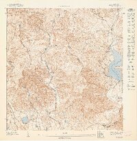
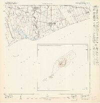
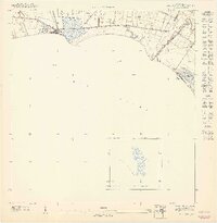
Other maps of this area

1944 · Santa Isabel
USGS Topo · 1:30,000

1945 · Playa De Ponce
USGS Topo · 1:30,000

1945 · Ponce
USGS Topo · 1:30,000

1945 · Rio Descalabrado
USGS Topo · 1:30,000
1947 · Ponce NE
USGS Topo · 1:10,000
1947 · Playa De Ponce NE
USGS Topo · 1:10,000

1947 · Ponce SO
USGS Topo · 1:10,000
1947 · Santa Isabel NO
USGS Topo · 1:10,000
1947 · Rio Descalabrado SO
USGS Topo · 1:10,000
1947 · Rio Descalabrado NO
USGS Topo · 1:10,000