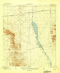
1919 Map of Playas
USGS Topo · Published 1946About this map
Playas Lake dominates the center of this 1917–1918 field survey, stretching through the basin between the high peaks of the Animas Mountains and the lower eastern hills. The transport corridor of the El Paso and Southwestern railroad cuts across the northern landscape, establishing the small settlements of Playas and Antelope as vital stops in this arid environment. The map records the sparse but significant human presence of the early twentieth century, such as the Whitmire Ranch located at the edge of the lake bed and the critical geographic crossing at Whitmire Pass. This era represents a period before major hydrological changes, showing the natural extent of the lake and the established cattle-and-rail economy that defined Hidalgo County. The work was overseen by Chief Geographer R.B. Marshall and reflects the meticulous topographical detail captured during the cooperation between the U.S. Geological Survey and the War Department.
Find a feature on this map
9 named features on this map. Tap any name to fly to it.
Don’t see what you’re looking for? This feature index may not catch every label — zoom into the map to look around manually.
Map Details
Editions of this 1919 Playas Map
4 editions found
Other maps of this area

1918 · Big Hatchet Peak
USGS Topo · 1:62,500

1918 · Hachita
USGS Topo · 1:62,500

1918 · Walnut Wells
USGS Topo · 1:62,500

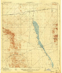
1918 · Playas
USGS Topo · 1:62,500

1918 · Animas Peak
USGS Topo · 1:62,500

1918 · Pratt
USGS Topo · 1:62,500

1919 · Pratt
USGS Topo · 1:62,500

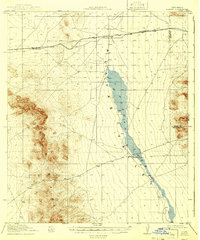
1919 · Playas
USGS Topo · 1:62,500

1920 · Animas Peak
USGS Topo · 1:62,500

1923 · Walnut Wells
USGS Topo · 1:62,500