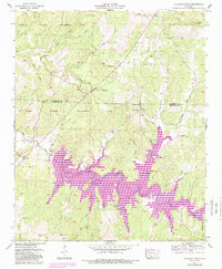
1957 Map of Pleasant Grove
USGS Topo · Published 1989About this map
Thomas Wildlife Management Area dominates the northern landscape of this Franklin County region, where the terrain is defined by a dense network of creek branches and hollows. The most striking transformation in the area is the presence of Cedar Creek Lake, held by the Cedar Creek Dam. This water feature, highlighted in purple revisions from the late 1980s, flooded the valley once defined by the original meandering course of Cedar Creek.
Find a feature on this map
43 named features on this map. Tap any name to fly to it.
Don’t see what you’re looking for? This feature index may not catch every label — zoom into the map to look around manually.
Map Details
Editions of this 1957 Pleasant Grove Map
3 editions found
Other maps of this area

1925 · Barton
USGS Topo · 1:62,500

1926 · Barton
USGS Topo · 1:48,000

1929 · Barton
USGS Topo · 1:62,500

1935 · Pleasant Site
USGS Topo · 1:24,000

1936 · Frankfort
USGS Topo · 1:24,000

1936 · Pleasant Grove
USGS Topo · 1:24,000

1936 · Isbell
USGS Topo · 1:24,000

1936 · Pride
USGS Topo · 1:24,000
1936 · Barton
USGS Topo · 1:24,000

1936 · Halltown
USGS Topo · 1:24,000