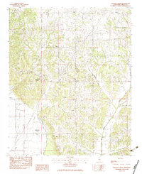
1983 Map of Pleasant Grove
USGS Topo · Published 1983About this map
The community of Pleasant Grove and the small settlement of Horatio anchor this rural landscape in Panola County, defined by a complex network of waterways including Butterbowl Creek, Arkabutla Cr, and the branching forks of Peach Creek. In the early 1980s, this area reflects a deeply rooted community life, evidenced by the high concentration of named churches such as Howard Chapel, Harmonious Ch, and Shiloh Ch scattered throughout the hills.
Find a feature on this map
33 named features on this map. Tap any name to fly to it.
Don’t see what you’re looking for? This feature index may not catch every label — zoom into the map to look around manually.
Map Details
Editions of this 1983 Pleasant Grove Map
This is the sole edition of this map. No revisions or reprints were ever made.
Other maps of this area

1932 · Sledge
USGS Topo · 1:48,000

1932 · Crenshaw
USGS Topo · 1:62,500

1935 · Crenshaw
USGS Topo · 1:62,500

1935 · Sledge
USGS Topo · 1:62,500

1939 · Sledge
USGS Topo · 1:62,500

1944 · Senatobia
USGS Topo · 1:62,500

1948 · Helena
USGS Topo · 1:250,000

1950 · Helena
USGS Topo · 1:250,000

1952 · Sardis
USGS Topo · 1:62,500

1953 · Sardis
USGS Topo · 1:62,500