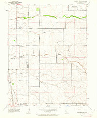
1953 Map of Pleasant Grove
USGS Topo · Published 1962About this map
The agricultural heart of the Sacramento Valley is captured here in the early 1950s, defined by its flat landscape and the essential waterways of Auburn Ravine, Pleasant Grove Creek, and Curry Creek. The boundary between Sutter Co Placer Co bisects the area, where rural life centered on the small settlement of Pleasant Grove and the nearby Alpha Sch. Evidence of the era's infrastructure is prominent, including the KFBK Radio Towers and Scheidel Field landing strip, reflecting a mid-century balance of traditional farming and modern communication.
Find a feature on this map
22 named features on this map. Tap any name to fly to it.
Don’t see what you’re looking for? This feature index may not catch every label — zoom into the map to look around manually.
Map Details
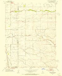
Editions of this 1953 Pleasant Grove Map
2 editions found
Other maps of this area

1891 · Sacramento
USGS Topo · 1:125,000

1892 · Sacramento
USGS Topo · 1:125,000

1893 · Sacramento
USGS Topo · 1:125,000

1902 · Fairoaks
USGS Topo · 1:62,500

1907 · Davisville
USGS Topo · 1:62,500

1910 · Sheridan
USGS Topo · 1:31,680

1910 · Lincoln
USGS Topo · 1:31,680

1910 · Roseville
USGS Topo · 1:31,680

1910 · Vernon
USGS Topo · 1:31,680

1910 · Nicolaus
USGS Topo · 1:31,680