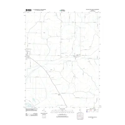
2012 Map of Pleasant Hill East
USGS Topo · Published 2012About this map
Nebo serves as the primary hub in this rural Pike County landscape, situated at the junction of Bridge St and S St. The surrounding countryside is defined by a dense concentration of family cemeteries, including Hartsock Cem, Mason Cem, and Hutton Cem, which indicate long-standing generational ties to the land. Waterways like Bay Cr and its tributaries, such as Buck Br and Spring Cr, snake through the terrain, while the Bay Creek Diversion ditch near Crooked Slough suggests active water management in the lowlands. To the south, the terrain descends into Howell Hollow, a named geographical feature that shares its name with the small settlement of Howell Hollow. This area reflects a quiet agricultural economy structured by a grid of rural routes like Road 300 N and Road 600 N.
Find a feature on this map
67 named features on this map. Tap any name to fly to it.
Don’t see what you’re looking for? This feature index may not catch every label — zoom into the map to look around manually.
Map Details
Editions of this 2012 Pleasant Hill East Map
This is the sole edition of this map. No revisions or reprints were ever made.
Other maps of this area

1924 · Griggsville
USGS Topo · 1:62,500

1926 · Griggsville
USGS Topo · 1:62,500

1926 · Pittsfield
USGS Topo · 1:62,500

1930 · Pearl
USGS Topo · 1:62,500

1930 · Nebo
USGS Topo · 1:62,500

1934 · Nebo
USGS Topo · 1:48,000

1942 · Nebo
USGS Topo · 1:62,500

1948 · Quincy
USGS Topo · 1:250,000

1950 · Pearl
USGS Topo · 1:62,500

1956 · Quincy
USGS Topo · 1:250,000