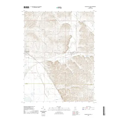
2021 Map of Pleasant Hill East
USGS Topo · Published 2021About this map
Pleasant Hill and Nebo anchor this rural landscape in the southwestern corner of Pike County, where the hills drop away toward the Mississippi River floodplain. The terrain is defined by a dense network of drainages including Bay Creek, Spring Cr, and Buck Br, which carve deep valleys such as Howell Hollow and Wildcat Hollow into the bluffs. This 2021 survey reveals a high concentration of small, family-named burial grounds that speak to generations of local settlement, with sites like Hartsock Cem, Mason Cem, and New Venable Cem scattered across the uplands. Near the southern boundary with Calhoun County, the landscape transitions from these dissected ridges to the low-lying Crooked Slough and Dolman Pond, marking the edge of the river bottomlands. The map serves as a detailed record of modern rural infrastructure, tracing numerous county roads and township lines that follow the underlying topography of the Illinois river bluffs.
Find a feature on this map
83 named features on this map. Tap any name to fly to it.
Don’t see what you’re looking for? This feature index may not catch every label — zoom into the map to look around manually.
Map Details
Editions of this 2021 Pleasant Hill East Map
This is the sole edition of this map. No revisions or reprints were ever made.
Other maps of this area

1924 · Griggsville
USGS Topo · 1:62,500

1926 · Griggsville
USGS Topo · 1:62,500

1926 · Pittsfield
USGS Topo · 1:62,500

1930 · Pearl
USGS Topo · 1:62,500

1930 · Nebo
USGS Topo · 1:62,500

1934 · Nebo
USGS Topo · 1:48,000

1942 · Nebo
USGS Topo · 1:62,500

1948 · Quincy
USGS Topo · 1:250,000

1950 · Pearl
USGS Topo · 1:62,500

1956 · Quincy
USGS Topo · 1:250,000