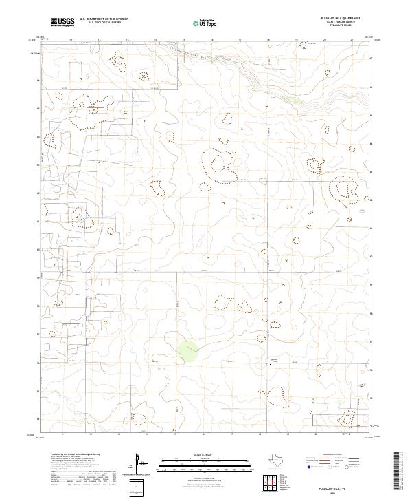
2022 Map of Pleasant Hill
USGS Topo · Published 2022About this map
Sulphur Springs Draw meanders across the northern reaches of this landscape, carving a subtle path through the high plains of Yoakum County. This 2022 survey by the U.S. Geological Survey documents a region defined by its orderly grid of county roads and agricultural infrastructure. In the southeastern portion of the sheet, Pleasant Hill Cem serves as a significant landmark for genealogists and local historians, situated near the intersection of Fm 330 and Co RD 435. The map illustrates the transition of the West Texas terrain, where major arteries like Fm 213 and Bennett Rd provide the primary framework for access across the sparsely settled ranch and farmland. The placement of cattle tanks and water features suggests a landscape managed for livestock and seasonal moisture management.
Find a feature on this map
19 named features on this map. Tap any name to fly to it.
Don’t see what you’re looking for? This feature index may not catch every label — zoom into the map to look around manually.
Map Details
Editions of this 2022 Pleasant Hill Map
This is the sole edition of this map. No revisions or reprints were ever made.
Other maps of this area

1954 · Hobbs
USGS Topo · 1:250,000

1954 · Brownfield
USGS Topo · 1:250,000

1958 · Brownfield
USGS Topo · 1:250,000

1958 · Hobbs
USGS Topo · 1:250,000

1962 · Brownfield
USGS Topo · 1:250,000

1970 · Seagraves
USGS Topo · 1:24,000

1970 · Tokio
USGS Topo · 1:24,000

1970 · Tokio NW
USGS Topo · 1:24,000
1970 · Tokio SE
USGS Topo · 1:24,000

1970 · Pleasant Hill
USGS Topo · 1:24,000