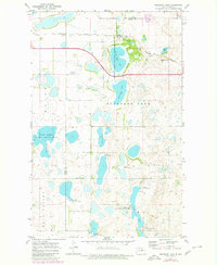
1971 Map of Pleasant Lake
USGS Topo · Published 1980About this map
Pleasant Lake National Wildlife Refuge anchors this North Dakota landscape, where the prairie is defined by a dense network of glacial wetlands and alkaline basins. The boundary between Pierce Co and Benson Co bisects the terrain, revealing an environment primarily dedicated to conservation and the Burlington Northern railroad corridor. The rail line skirts the northern edge of several water bodies, including Sand Lake, Broken Bone Lake, and Mud Lake, highlighting the historic importance of the railroad in navigating this water-heavy region.
Find a feature on this map
19 named features on this map. Tap any name to fly to it.
Don’t see what you’re looking for? This feature index may not catch every label — zoom into the map to look around manually.
Map Details
Editions of this 1971 Pleasant Lake Map
2 editions found
Other maps of this area

1953 · Devils Lake
USGS Topo · 1:250,000

1954 · Rugby NW
USGS Topo · 1:24,000

1955 · Rugby
USGS Topo · 1:24,000

1956 · Devils Lake
USGS Topo · 1:250,000

1958 · Fillmore
USGS Topo · 1:24,000
1958 · Silva
USGS Topo · 1:24,000

1958 · Baker
USGS Topo · 1:24,000

1971 · Wolford
USGS Topo · 1:24,000

1971 · Knox
USGS Topo · 1:24,000

1971 · Rugby NE
USGS Topo · 1:24,000