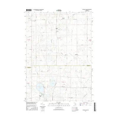
2017 Map of Pleasant Lake
USGS Topo · Published 2017About this map
Bunker Hill sits at a topographic high point in this rural landscape, marking a central node in a network of historic burial grounds and local drainages. The area is defined by a series of significant cemeteries, including Saint Cornelius and Cyprian's Catholic Cem and Bunker Hill Center Cem, which serve as vital markers for genealogical research in this part of Michigan. The terrain is characterized by a complex hydrology where Batteese Cr and Cahogan Cr weave through wetlands toward larger bodies of water like Batteese Lake and the eponymous Pleasant Lake. To the south, the Lakelands Trail State Park follows an established corridor near the Jackson County line, while the crossroads of Fitchburg remains a distinct settlement point. This survey documents the intersection of long-standing family farm roads like Haynes Rd and Freiermuth Rd with the enduring township boundaries.
Find a feature on this map
75 named features on this map. Tap any name to fly to it.
Don’t see what you’re looking for? This feature index may not catch every label — zoom into the map to look around manually.
Map Details
Editions of this 2017 Pleasant Lake Map
This is the sole edition of this map. No revisions or reprints were ever made.
Other maps of this area

1908 · Fowlerville
USGS Topo · 1:62,500

1909 · Mason
USGS Topo · 1:62,500

1910 · Fowlerville
USGS Topo · 1:62,500

1911 · Mason
USGS Topo · 1:62,500

1919 · Stockbridge
USGS Topo · 1:62,500

1919 · Rives Junction
USGS Topo · 1:62,500

1921 · Rives Junction
USGS Topo · 1:62,500

1922 · Stockbridge
USGS Topo · 1:62,500

1942 · Stockbridge
USGS Topo · 1:62,500

1958 · Grand Rapids
USGS Topo · 1:250,000