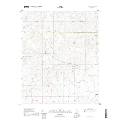
2020 Map of Pleasant Ridge
USGS Topo · Published 2020About this map
Dumas and Pleasant Ridge anchor this landscape along the Tippah and Union county line, where a network of country roads connects scattered family cemeteries and small rural settlements. The terrain is defined by prominent elevations such as Oak Hill Hill, Rockpile Hill, and Sweden Hill, which overlook the headwaters of the Hatchie River. This hydrological pattern, including the winding Hatchie Br and Tishomingo Cr, reveals the drainage systems of the Tippah Hills. Local history is deeply rooted in the land, as evidenced by landmarks like Mount Zion Cem and Bartlett Cem situated near Owens Br. The presence of County Lake and the various branches feeding into Little Cr and Hall Cr illustrate the rural character of this northern Mississippi region.
Find a feature on this map
103 named features on this map. Tap any name to fly to it.
Don’t see what you’re looking for? This feature index may not catch every label — zoom into the map to look around manually.
Map Details
Editions of this 2020 Pleasant Ridge Map
This is the sole edition of this map. No revisions or reprints were ever made.
Other maps of this area

1921 · Booneville
USGS Topo · 1:48,000

1921 · Tupelo
USGS Topo · 1:48,000

1922 · Booneville
USGS Topo · 1:62,500

1923 · Tupelo
USGS Topo · 1:62,500

1955 · Ripley
USGS Topo · 1:62,500

1955 · Sherman
USGS Topo · 1:62,500

1956 · Tupelo
USGS Topo · 1:250,000

1958 · Tupelo
USGS Topo · 1:250,000

1972 · Jumpertown
USGS Topo · 1:24,000

1973 · Guntown
USGS Topo · 1:24,000