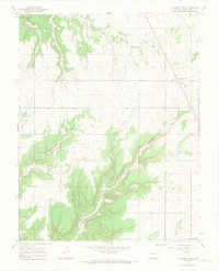
1965 Map of Pleasant View
USGS Topo · Published 1968About this map
Pleasant View and Cahone serve as the primary anchors for this mid-1960s landscape in Montezuma County. The topography is dominated by a complex system of drainage, where the relatively flat agricultural plains of the northeast are abruptly cut by deep, branching canyons. Significant geological features include the winding reaches of Hovenweep Canyon and Sandstone Canyon, which illustrate the erosion patterns characteristic of the Colorado Plateau. The survey also documents smaller seasonal watercourses such as Little Cahone Canyon, Ruin Canyon, and Negro Canyon. Outside of the small settlements, human infrastructure is sparse, noted primarily by a single Radio Tower and the grid of section lines that define the local ranching and farming boundaries. This map captures the area just as modern photogrammetric mapping was being refined, providing a clear record of the intersection between high-desert terrain and rural development.
Find a feature on this map
11 named features on this map. Tap any name to fly to it.
Don’t see what you’re looking for? This feature index may not catch every label — zoom into the map to look around manually.
Map Details
Editions of this 1965 Pleasant View Map
2 editions found
Other maps of this area

1956 · Cortez
USGS Topo · 1:250,000

1957 · Moqui NW
USGS Topo · 1:24,000

1957 · Cedar 3 NW
USGS Topo · 1:24,000

1957 · Cedar 3 SW
USGS Topo · 1:24,000

1958 · Cortez
USGS Topo · 1:250,000

1959 · Cortez
USGS Topo · 1:250,000

1962 · Cortez
USGS Topo · 1:250,000

1965 · Cahone
USGS Topo · 1:24,000

1965 · Woods Canyon
USGS Topo · 1:24,000

1965 · Yellow Jacket
USGS Topo · 1:24,000