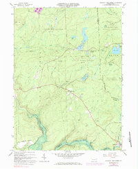
1965 Map of Pleasant View Summit
USGS Topo · Published 1984About this map
State Game Lands No 91 dominates this 1960s landscape, where the borders of Luzerne, Lackawanna, Monroe, and Carbon counties converge. The terrain is defined by a series of high ridges and swamps, including Bear Swamp and Horseshoe Swamp, draining into the Lehigh River to the south. Small settlements like Pleasant View Summit and Shades Glen sit along the central ridge, while the historic hamlet of Stoddartsville marks the river crossing at the southeastern corner.
Find a feature on this map
40 named features on this map. Tap any name to fly to it.
Don’t see what you’re looking for? This feature index may not catch every label — zoom into the map to look around manually.
Map Details
Editions of this 1965 Pleasant View Summit Map
4 editions found
Other maps of this area

1889 · Scranton
USGS Topo · 1:62,500

1891 · Wilkesbarre
USGS Topo · 1:62,500

1891 · Scranton
USGS Topo · 1:62,500

1893 · Pittston
USGS Topo · 1:62,500

1893 · Scranton
USGS Topo · 1:62,500

1894 · Wilkesbarre
USGS Topo · 1:62,500

1922 · Stoddartsville
USGS Topo · 1:62,500

1924 · Stoddartsville
USGS Topo · 1:62,500

1943 · Scranton
USGS Topo · 1:125,000

1943 · Stoddartsville
USGS Topo · 1:62,500
Featured Places
- Thornhurst Township, PA
- Kidder Township, PA
- Buck Township, PA
- Tobyhanna Township, PA
- Pleasant View Summit, Bear Creek Township