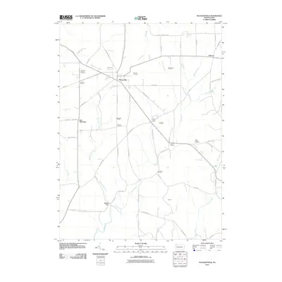
2010 Map of Pleasantville
USGS Topo · Published 2010About this map
Pleasantville serves as the central hub of this northern Pennsylvania landscape, situated at the intersection of local routes in the heart of Venango County's oil-producing territory. The region is characterized by a legacy of early energy extraction, evidenced by the large footprints of the Pleasantville Oil Field and the Shamburg Oil Field. These industrial sites are interspersed with several small communities and family-named intersections such as Jerusalem Corners, Morrison Corners, and Rumbaugh Corners.
Find a feature on this map
69 named features on this map. Tap any name to fly to it.
Don’t see what you’re looking for? This feature index may not catch every label — zoom into the map to look around manually.
Map Details
Editions of this 2010 Pleasantville Map
This is the sole edition of this map. No revisions or reprints were ever made.
Other maps of this area

1922 · Oil City
USGS Topo · 1:48,000

1922 · Tionesta
USGS Topo · 1:62,500

1924 · Oil City
USGS Topo · 1:62,500

1924 · Tionesta
USGS Topo · 1:62,500

1927 · Tidioute
USGS Topo · 1:48,000

1927 · Titusville
USGS Topo · 1:62,500

1930 · Tidioute
USGS Topo · 1:62,500

1933 · Titusville
USGS Topo · 1:62,500

1943 · Oil City
USGS Topo · 1:62,500

1946 · Tionesta
USGS Topo · 1:62,500
Featured Places
- Pleasantville, PA
- President Township, PA
- Allegheny Township, PA
- Morrison Corners, Oil Creek Township
- East Shamburg, Oil Creek Township