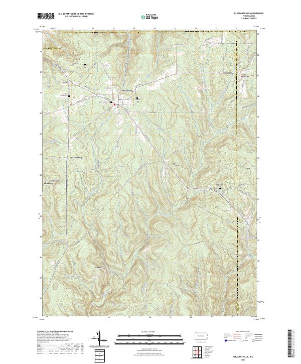
2023 Map of Pleasantville
USGS Topo · Published 2023About this map
Pleasantville serves as the primary hub of this landscape where Venango, Crawford, and Forest counties meet. The terrain is deeply carved by the Pithole Creek drainage system, which includes numerous named tributaries like West Pithole Creek and Allender Run. This area is characterized by its rural settlement pattern, anchored by small clusters at Neilltown, Shamburg, and the site of Pithole City.
Find a feature on this map
84 named features on this map. Tap any name to fly to it.
Don’t see what you’re looking for? This feature index may not catch every label — zoom into the map to look around manually.
Map Details
Editions of this 2023 Pleasantville Map
This is the sole edition of this map. No revisions or reprints were ever made.
Other maps of this area

1922 · Oil City
USGS Topo · 1:48,000

1922 · Tionesta
USGS Topo · 1:62,500

1924 · Oil City
USGS Topo · 1:62,500

1924 · Tionesta
USGS Topo · 1:62,500

1927 · Tidioute
USGS Topo · 1:48,000

1927 · Titusville
USGS Topo · 1:62,500

1930 · Tidioute
USGS Topo · 1:62,500

1933 · Titusville
USGS Topo · 1:62,500

1943 · Oil City
USGS Topo · 1:62,500

1946 · Tionesta
USGS Topo · 1:62,500
Featured Places
- Pleasantville, PA
- President Township, PA
- Allegheny Township, PA
- Oil Creek Township, PA
- Cornplanter Township, PA