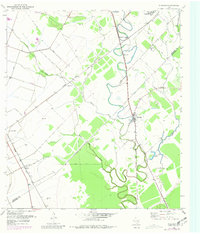
1952 Map of Pledger
USGS Topo · Published 1981About this map
The Wharton Co Matagorda Co line divides this landscape of fertile bottomlands and industrial infrastructure. Settlement patterns follow the winding course of Caney Creek and the rail corridors, with the Southern Pacific and the Atchison Topeka and Santa Fe providing the primary transportation spine for agricultural and resource extraction. The community of Pledger sits at a critical junction near Union Cem, while the northern reaches are dominated by Newgulf and Newgulf Junction. Extensive engineering works, including a complex system of levee structures, spoil bank deposits, and a Salt Water Canal, suggest a landscape heavily managed for water control and industrial use. Smaller named locales such as Don-Tol, Arye, and Magnet illustrate the dense network of rail-side hamlets and work sites common in mid-century Texas.
Find a feature on this map
25 named features on this map. Tap any name to fly to it.
Don’t see what you’re looking for? This feature index may not catch every label — zoom into the map to look around manually.
Map Details
Editions of this 1952 Pledger Map
Other maps of this area

1950 · Houston
USGS Topo · 1:250,000

1952 · Danciger
USGS Topo · 1:24,000

1952 · Ashwood
USGS Topo · 1:24,000

1952 · Lane City SE
USGS Topo · 1:24,000

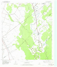
1952 · Pledger
USGS Topo · 1:24,000

1952 · Lane City
USGS Topo · 1:24,000

1952 · Van Vleck
USGS Topo · 1:24,000

1953 · Guy
USGS Topo · 1:24,000

1953 · Wharton
USGS Topo · 1:24,000

1953 · Boling
USGS Topo · 1:24,000