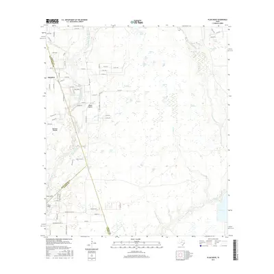
2016 Map of Plum Grove
USGS Topo · Published 2016About this map
Plum Grove and Roman Forest anchor this East Texas landscape where the coastal plain begins to fragment into a complex network of wetlands and bayous. The E Fork San Jacinto River defines the western edge, while the eastern portion is dominated by the winding path of Tarkington Bayou. The terrain between these waterways is notable for an extraordinary concentration of named ponds and depressions, such as Thompson Grass Pond, Button Willow Ponds, and John Garner Pond.
Find a feature on this map
95 named features on this map. Tap any name to fly to it.
Don’t see what you’re looking for? This feature index may not catch every label — zoom into the map to look around manually.
Map Details
Editions of this 2016 Plum Grove Map
This is the sole edition of this map. No revisions or reprints were ever made.
Other maps of this area

1916 · Moonshine Hill
USGS Topo · 1:24,000

1916 · Huffman
USGS Topo · 1:24,000

1920 · Moonshine Hill
USGS Topo · 1:31,680

1920 · Huffman
USGS Topo · 1:31,680

1943 · Liberty
USGS Topo · 1:125,000

1954 · Beaumont
USGS Topo · 1:250,000

1955 · Rayburn
USGS Topo · 1:62,500

1955 · Liberty
USGS Topo · 1:62,500

1957 · Beaumont
USGS Topo · 1:250,000

1958 · Fostoria
USGS Topo · 1:24,000