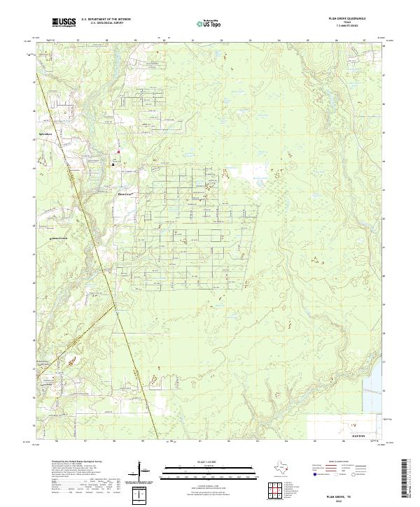
2022 Map of Plum Grove
USGS Topo · Published 2022About this map
The E Fork San Jacinto River winds through this corner of the Texas Gulf Coast, shaping a landscape defined by an intricate network of wetlands and named ponds. The settlement at Plum Grove is central to the area, located near the Plum Grove Cem and the Paul Campbell Loop. The map illustrates the residential expansion radiating from nearby Splendora and Roman Forest into the woodland and pasture of Liberty County. Numerous distinct water bodies, including Wildcat Pond, China Pond, and Alligator Pond, are scattered across the terrain east of the river, while Tarkington Bayou marks the eastern edge. A dense grid of rural roads and residential lanes, such as Riverside Dr and various numbered routes, shows the transition from timberland and ranching toward suburban development. This 2022 survey records the modern footprint of communities like Casey Ridge at a time of continued growth between the river forks and the bayou.
Find a feature on this map
137 named features on this map. Tap any name to fly to it.
Don’t see what you’re looking for? This feature index may not catch every label — zoom into the map to look around manually.
Map Details
Editions of this 2022 Plum Grove Map
This is the sole edition of this map. No revisions or reprints were ever made.
Other maps of this area

1916 · Moonshine Hill
USGS Topo · 1:24,000

1916 · Huffman
USGS Topo · 1:24,000

1920 · Moonshine Hill
USGS Topo · 1:31,680

1920 · Huffman
USGS Topo · 1:31,680

1943 · Liberty
USGS Topo · 1:125,000

1954 · Beaumont
USGS Topo · 1:250,000

1955 · Rayburn
USGS Topo · 1:62,500

1955 · Liberty
USGS Topo · 1:62,500

1957 · Beaumont
USGS Topo · 1:250,000

1958 · Fostoria
USGS Topo · 1:24,000