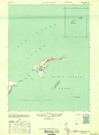
1947 Map of Plum Island
USGS Topo · Published 1947About this map
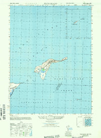
Fort Terry dominates the landscape of Plum Island in this post-war military survey, showing the installation's network of roads and structures at a time of significant transition. Situated where Long Island Sound meets Block Island Sound, the island's strategic maritime position is marked by a Lighthouse at its western tip near Plum Gut. The map records the approximate military reservation boundaries as they stood in 1947, including the Ferry Landing that served as the primary link to Orient Pt on the mainland. Further east, the small outposts of Great Gull Island and Little Gull Island are detailed, the latter featuring its own Lighthouse. To the south in Gardiners Bay, the map captures the USC&GS Ruin at Gardiners Point, providing a specific record of coastal survey markers and military presence in this critical New York waterway.
Find a feature on this map
18 named features on this map. Tap any name to fly to it.
Don’t see what you’re looking for? This feature index may not catch every label — zoom into the map to look around manually.
Map Details
Editions of this 1947 Plum Island Map
2 editions found
Other maps of this area

1892 · New London
USGS Topo · 1:62,500

1893 · New London
USGS Topo · 1:62,500

1893 · Saybrook
USGS Topo · 1:62,500

1903 · Gardiners Island
USGS Topo · 1:62,500

1904 · Shelter Island
USGS Topo · 1:62,500

1904 · Gardiners Island
USGS Topo · 1:62,500

1921 · Gardiners Island
USGS Topo · 1:62,500

1921 · New London
USGS Topo · 1:62,500

1934 · Niantic
USGS Topo · 1:24,000

1938 · New London
USGS Topo · 1:31,680
Featured Places
- East Hampton, NY
- Southold, NY
- Orient, Southold
- Suffolk County, NY
- Southeastern Connecticut Planning Region, CT