
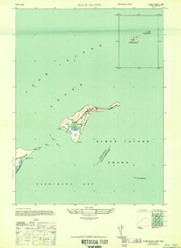
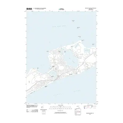
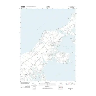
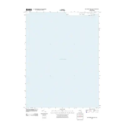
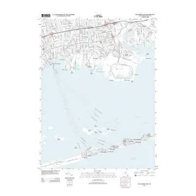
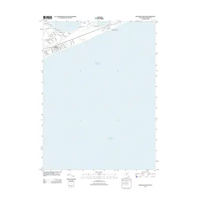
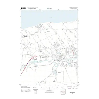
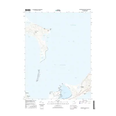
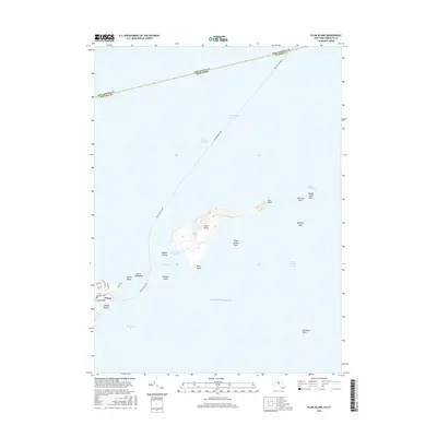
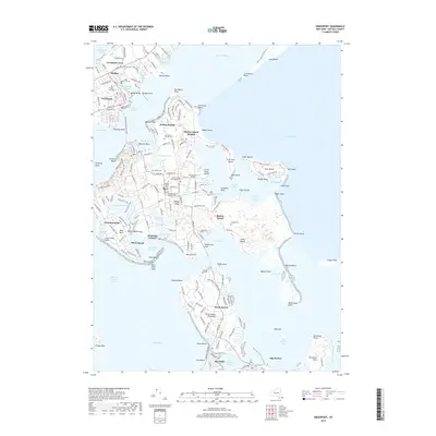
1947 Map of Plum Island
USGS Topo · Published 1948About this map
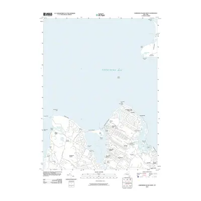
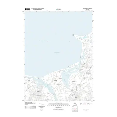
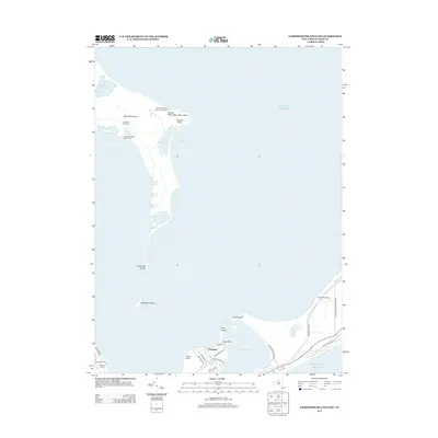
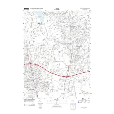
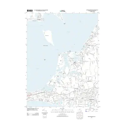
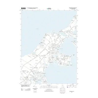
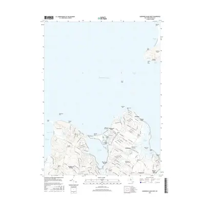
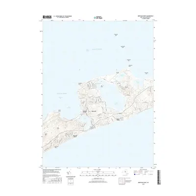
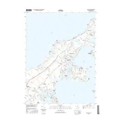
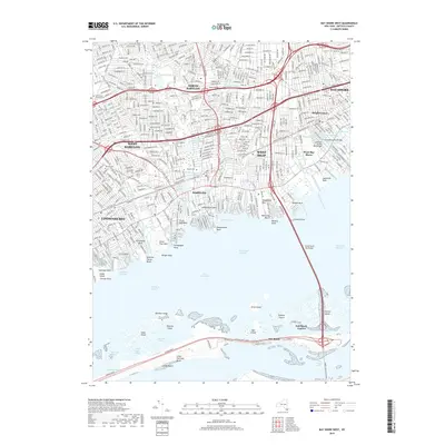
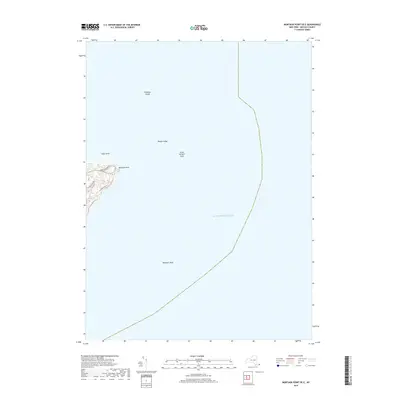
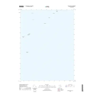
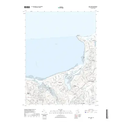
Plum Island and its surrounding archipelago dominate this maritime survey, illustrating the strategic and navigational landscape of eastern Suffolk County shortly after World War II. The island itself is largely occupied by a military reservation and the installations of Fort Terry, featuring an intricate network of buildings and roads concentrated on its northern and eastern ends. A Ferry Landing on the western shore and a Lighthouse on the southwestern tip suggest the isolation and tactical importance of this outpost situated within the turbulent waters of Plum Gut. To the east, the smaller outcrops of Great Gull Island and Little Gull Island further define the passage between Long Island Sound and Block Island Sound, while the southern reaches identify a USC&GS Ruin at Gardiners Point, offering a glimpse into the region's earlier coastal surveying history.
Find a feature on this map
17 named features on this map. Tap any name to fly to it.
Don’t see what you’re looking for? This feature index may not catch every label — zoom into the map to look around manually.
Map Details
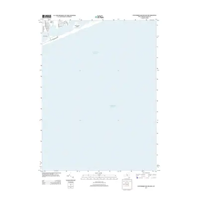
Editions of this 1947 Plum Island Map
2 editions found
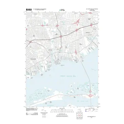
Historical Maps of East Hampton Through Time
168 maps found

1901 Babylon
Suffolk County, NY

1903 Babylon
Suffolk County, NY

1903 Riverhead
Suffolk County, NY

1904 East Hampton
Suffolk County, NY

1904 Islip
Suffolk County, NY

1904 Riverhead
Suffolk County, NY

1919 Babylon
Suffolk County, NY

1921 Easthampton
Suffolk County, NY

1941 Bay Shore West
Suffolk County, NY

1942 Islip
Suffolk County, NY

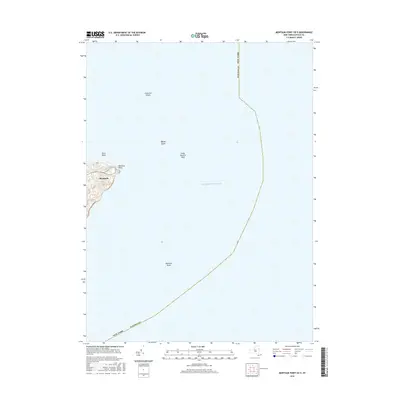
1942 Montauk Point
Suffolk County, NY

1943 Gardiners Island East
Suffolk County, NY

1943 Riverhead
Suffolk County, NY

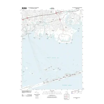
1944 Bay Shore East
Suffolk County, NY

1944 Gardiners Island West
Suffolk County, NY

1947 East Hampton
Suffolk County, NY

1947 Greenport
Suffolk County, NY

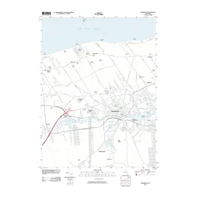
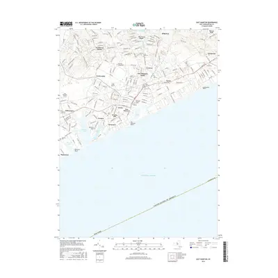
1947 Howells Point
Suffolk County, NY

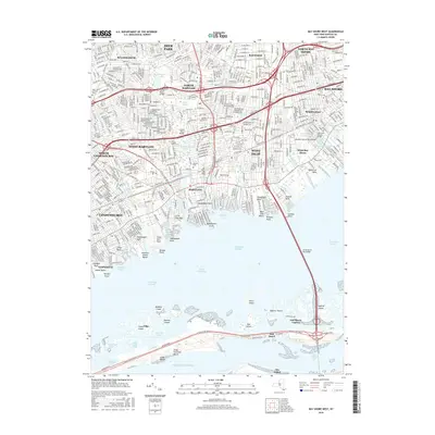
1947 Huntington
Suffolk County, NY

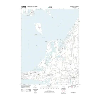
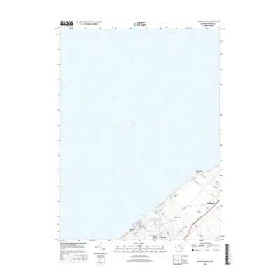
1947 Mattituck Hills
Suffolk County, NY

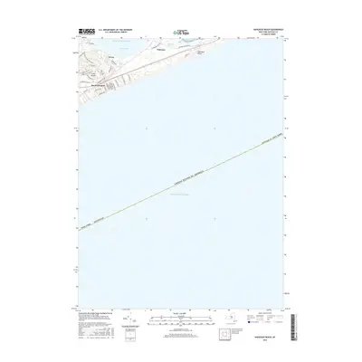
1947 Napeague Beach
Suffolk County, NY
1947 Plum Island
Suffolk County, NY

1947 Riverhead
Suffolk County, NY

1947 Shinnecock Bay
Suffolk County, NY

1947 Southampton
Suffolk County, NY

1947 Southold
Suffolk County, NY

1947 St James
Suffolk County, NY

1954 Bay Shore West
Suffolk County, NY

1954 Huntington
Suffolk County, NY

1954 Plum Island
Suffolk County, NY

1955 Bay Shore East
Suffolk County, NY

1955 Saint James
Suffolk County, NY

1955 Shinnecock Inlet
Suffolk County, NY

1956 East Hampton
Suffolk County, NY

1956 Gardiners Island East
Suffolk County, NY

1956 Gardiners Island West
Suffolk County, NY

1956 Greenport
Suffolk County, NY

1956 Howells Point
Suffolk County, NY

1956 Mattituck Hills
Suffolk County, NY

1956 Montauk Point
Suffolk County, NY

1956 Napeague Beach
Suffolk County, NY

1956 Pattersquash Island
Suffolk County, NY

1956 Riverhead
Suffolk County, NY

1956 Southampton
Suffolk County, NY

1956 Southold
Suffolk County, NY

1967 Bay Shore East
Suffolk County, NY

1967 Howells Point
Suffolk County, NY

1967 Huntington
Suffolk County, NY

1967 Pattersquash Island
Suffolk County, NY

1967 Saint James
Suffolk County, NY

1969 Bay Shore West
Suffolk County, NY

1984 Long Island East
Suffolk County, NY

1984 Long Island West
Suffolk County, NY
2010 Bay Shore East OE S
Suffolk County, NY
2010 East Hampton
Suffolk County, NY
2010 Gardiners Island East
Suffolk County, NY
2010 Gardiners Island West
Suffolk County, NY
2010 Greenport
Suffolk County, NY
2010 Howells Point
Suffolk County, NY

2010 Huntington
Suffolk County, NY
2010 Mattituck Hills
Suffolk County, NY
2010 Montauk Point
Suffolk County, NY
2010 Napeague Beach
Suffolk County, NY
2010 Pattersquash Island
Suffolk County, NY
2010 Plum Island
Suffolk County, NY
2010 Riverhead
Suffolk County, NY
2010 Southampton
Suffolk County, NY
2010 Southold
Suffolk County, NY
2011 Bay Shore East
Suffolk County, NY
2011 Bay Shore West OE S
Suffolk County, NY
2011 Bay Shore West
Suffolk County, NY
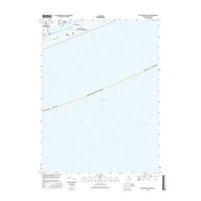
2011 Plum Island OE E
Suffolk County, NY
2011 Sag Harbor OE S
Suffolk County, NY
2011 Saint James
Suffolk County, NY
2012 Montauk Point OE E
Suffolk County, NY
2012 Shinnecock Inlet
Suffolk County, NY
2013 Bay Shore East OE S
Suffolk County, NY
2013 Bay Shore East
Suffolk County, NY
2013 Bay Shore West OE S
Suffolk County, NY
2013 Bay Shore West
Suffolk County, NY
2013 East Hampton
Suffolk County, NY
2013 Gardiners Island East
Suffolk County, NY
2013 Gardiners Island West
Suffolk County, NY
2013 Greenport
Suffolk County, NY
2013 Howells Point
Suffolk County, NY
2013 Huntington
Suffolk County, NY
2013 Mattituck Hills
Suffolk County, NY
2013 Montauk Point OE E
Suffolk County, NY
2013 Montauk Point
Suffolk County, NY
2013 Napeague Beach
Suffolk County, NY
2013 Pattersquash Island
Suffolk County, NY
2013 Plum Island OE E
Suffolk County, NY
2013 Plum Island
Suffolk County, NY
2013 Riverhead
Suffolk County, NY
2013 Sag Harbor OE S
Suffolk County, NY
2013 Saint James
Suffolk County, NY
2013 Shinnecock Inlet
Suffolk County, NY
2013 Southampton
Suffolk County, NY
2013 Southold
Suffolk County, NY
2016 Bay Shore East OE S
Suffolk County, NY
2016 Bay Shore East
Suffolk County, NY
2016 Bay Shore West OE S
Suffolk County, NY
2016 Bay Shore West
Suffolk County, NY
2016 East Hampton
Suffolk County, NY
2016 Gardiners Island East
Suffolk County, NY
2016 Gardiners Island West
Suffolk County, NY
2016 Greenport
Suffolk County, NY
2016 Howells Point
Suffolk County, NY
2016 Huntington
Suffolk County, NY
2016 Mattituck Hills
Suffolk County, NY
2016 Montauk Point OE E
Suffolk County, NY
2016 Montauk Point
Suffolk County, NY
2016 Napeague Beach
Suffolk County, NY
2016 Pattersquash Island
Suffolk County, NY
2016 Plum Island OE E
Suffolk County, NY
2016 Plum Island
Suffolk County, NY
2016 Riverhead
Suffolk County, NY
2016 Sag Harbor OE S
Suffolk County, NY
2016 Saint James
Suffolk County, NY
2016 Shinnecock Inlet
Suffolk County, NY
2016 Southampton
Suffolk County, NY
2016 Southold
Suffolk County, NY
2019 Bay Shore East OE S
Suffolk County, NY
2019 Bay Shore East
Suffolk County, NY
2019 Bay Shore West OE S
Suffolk County, NY
2019 Bay Shore West
Suffolk County, NY
2019 East Hampton
Suffolk County, NY
2019 Gardiners Island East
Suffolk County, NY
2019 Gardiners Island West
Suffolk County, NY
2019 Greenport
Suffolk County, NY
2019 Howells Point
Suffolk County, NY
2019 Huntington
Suffolk County, NY
2019 Mattituck Hills
Suffolk County, NY
2019 Montauk Point OE E
Suffolk County, NY
2019 Montauk Point
Suffolk County, NY
2019 Napeague Beach
Suffolk County, NY
2019 Pattersquash Island
Suffolk County, NY
2019 Plum Island OE E
Suffolk County, NY
2019 Plum Island
Suffolk County, NY
2019 Riverhead
Suffolk County, NY
2019 Sag Harbor OE S
Suffolk County, NY
2019 Saint James
Suffolk County, NY
2019 Shinnecock Inlet
Suffolk County, NY
2019 Southampton
Suffolk County, NY
2019 Southold
Suffolk County, NY

2023 Bay Shore East OE S
Suffolk County, NY

2023 Bay Shore East
Suffolk County, NY

2023 Bay Shore West OE S
Suffolk County, NY

2023 Bay Shore West
Suffolk County, NY

2023 East Hampton
Suffolk County, NY

2023 Gardiners Island East
Suffolk County, NY

2023 Gardiners Island West
Suffolk County, NY

2023 Greenport
Suffolk County, NY

2023 Howells Point
Suffolk County, NY

2023 Huntington
Suffolk County, NY

2023 Mattituck Hills
Suffolk County, NY

2023 Montauk Point OE E
Suffolk County, NY

2023 Montauk Point
Suffolk County, NY

2023 Napeague Beach
Suffolk County, NY

2023 Pattersquash Island
Suffolk County, NY

2023 Plum Island OE E
Suffolk County, NY

2023 Plum Island
Suffolk County, NY

2023 Riverhead
Suffolk County, NY

2023 Sag Harbor OE S
Suffolk County, NY

2023 Saint James
Suffolk County, NY

2023 Shinnecock Inlet
Suffolk County, NY

2023 Southampton
Suffolk County, NY

2023 Southold
Suffolk County, NY
Featured Locations
- Suffolk County, NY
- Southeastern Connecticut Planning Region, CT
- East Hampton, NY
- Southold, NY
- Orient, Southold