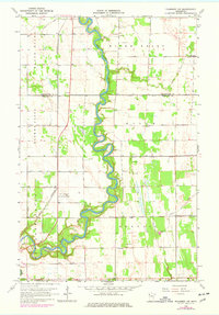
1964 Map of Plummer NW
USGS Topo · Published 1977About this map
The Red Lake River meanders deeply across this northwestern Minnesota landscape, forming the boundary between Pennington and Red Lake counties. This 1960s survey, with later revisions, shows an intensive water management system marked by numerous channels such as Judicial Ditch No 15 and County Ditch No 12, illustrating the conversion of river bottomlands into productive territory. The Great Northern railroad cuts a straight north-south path through the township of River Falls, connecting the rural interior to broader markets.
Find a feature on this map
22 named features on this map. Tap any name to fly to it.
Don’t see what you’re looking for? This feature index may not catch every label — zoom into the map to look around manually.
Map Details
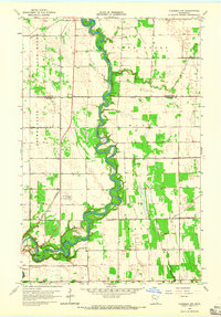
Editions of this 1964 Plummer NW Map
2 editions found
Other maps of this area

1918 · Terrebonne
USGS Topo · 1:62,500

1918 · Red Lake Falls
USGS Topo · 1:62,500

1918 · Viking
USGS Topo · 1:62,500

1943 · Thief River Falls
USGS Topo · 1:62,500

1952 · Red Lake Falls
USGS Topo · 1:62,500

1952 · Grand Forks
USGS Topo · 1:250,000

1952 · Thief River Falls
USGS Topo · 1:250,000

1956 · Thief River Falls
USGS Topo · 1:250,000

1956 · Grand Forks
USGS Topo · 1:250,000

1957 · Thief River Falls
USGS Topo · 1:250,000