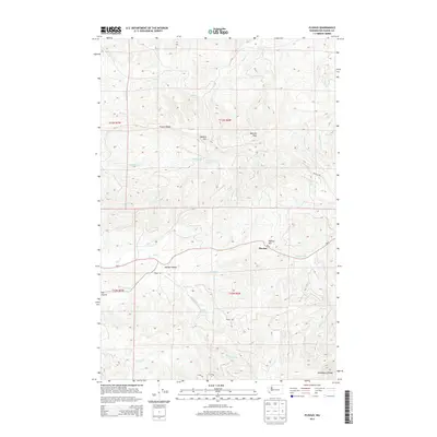
2013 Map of Pluvius
USGS Topo · Published 2013About this map
Pluvius and the surrounding Willapa Valley define this portion of Pacific County, where the headwaters of the Willapa River descend from the highlands of the Willapa Hills. The landscape is characterized by prominent high points like Walville Peak, Squally Jim, and Pluvius Hill, connected by a network of ridges including P and E Ridge and Huckleberry Ridge. The topographic detail reveals a complex drainage system where numerous creeks, such as Custer Cr, Salmon Cr, and Falls Cr, converge toward the valley floor. Wa-6 provides the primary transit corridor through the area, passing near Elk Prairie and the landmark Willapa Falls. This survey offers a clear view of the timbered uplands and the narrow, developed valley bottoms as they appeared in the early 21st century.
Find a feature on this map
32 named features on this map. Tap any name to fly to it.
Don’t see what you’re looking for? This feature index may not catch every label — zoom into the map to look around manually.
Map Details
Editions of this 2013 Pluvius Map
This is the sole edition of this map. No revisions or reprints were ever made.
Other maps of this area

1940 · Brookfield
USGS Topo · 1:62,500

1941 · Walville
USGS Topo · 1:62,500

1941 · Skamokawa
USGS Topo · 1:62,500

1953 · Hoquiam
USGS Topo · 1:250,000

1953 · Skamokawa
USGS Topo · 1:62,500

1953 · Pe Ell
USGS Topo · 1:62,500

1955 · Grays River
USGS Topo · 1:62,500

1955 · Raymond
USGS Topo · 1:62,500

1957 · Hoquiam
USGS Topo · 1:250,000

1958 · Hoquiam
USGS Topo · 1:250,000