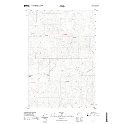
2020 Map of Pluvius
USGS Topo · Published 2020About this map
Pluvius occupies a strategic high point in the Pacific County hills, serving as a focal point for the surrounding timberlands and valleys. The landscape is defined by the winding Willapa River, which drops through Willapa Falls as it drains the western slopes of the Willapa Hills. The high-elevation terrain is marked by prominent landforms such as Walville Peak, Squally Jim, and the elongated P and E Ridge.
Find a feature on this map
35 named features on this map. Tap any name to fly to it.
Don’t see what you’re looking for? This feature index may not catch every label — zoom into the map to look around manually.
Map Details
Editions of this 2020 Pluvius Map
This is the sole edition of this map. No revisions or reprints were ever made.
Other maps of this area

1940 · Brookfield
USGS Topo · 1:62,500

1941 · Walville
USGS Topo · 1:62,500

1941 · Skamokawa
USGS Topo · 1:62,500

1953 · Hoquiam
USGS Topo · 1:250,000

1953 · Skamokawa
USGS Topo · 1:62,500

1953 · Pe Ell
USGS Topo · 1:62,500

1955 · Grays River
USGS Topo · 1:62,500

1955 · Raymond
USGS Topo · 1:62,500

1957 · Hoquiam
USGS Topo · 1:250,000

1958 · Hoquiam
USGS Topo · 1:250,000