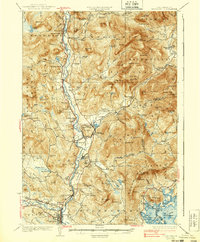
1931 Map of Plymouth
USGS Topo · Published 1939About this map
The Pemigewasset River valley forms the central corridor of this region, where the Boston And Maine railroad tracks trace the water's edge to serve a series of riverside settlements. From Woodstock in the north through Thornton and Campton Sta, the landscape transitions from industrial nodes like the Tripoli Mill near Hix Mtn to the academic and civic center of Plymouth in the south. The 1928 survey captures the dense network of local schools that anchored these mountain communities, including Thornton Sch, Mad River Sch, and Pulsifer Hill Sch.
Find a feature on this map
148 named features on this map. Tap any name to fly to it.
Don’t see what you’re looking for? This feature index may not catch every label — zoom into the map to look around manually.
Map Details
Editions of this 1931 Plymouth Map
5 editions found

Other maps of this area

1895 · Crawford Notch
USGS Topo · 1:62,500

1896 · Crawford Notch
USGS Topo · 1:62,500

1909 · Winnepesaukee
USGS Topo · 1:62,500

1925 · Holderness
USGS Topo · 1:62,500

1927 · Holderness
USGS Topo · 1:62,500

1927 · Cardigan
USGS Topo · 1:62,500

1928 · Plymouth
USGS Topo · 1:62,500

1928 · Rumney
USGS Topo · 1:62,500

1929 · Moosilauke
USGS Topo · 1:62,500

1929 · Franconia
USGS Topo · 1:62,500