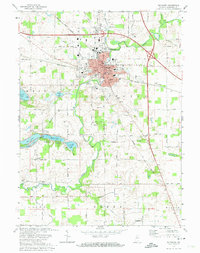
1972 Map of Plymouth
USGS Topo · Published 1974About this map
The Yellow River winds through the heart of Plymouth, anchoring a landscape defined by its intersection of water, rail, and early aviation. This early 1970s record shows the city as a regional hub, where the Penn Central and Norfolk and Western railroads cross near the city center. The surrounding Marshall County countryside is intricately carved by drainage systems like Norfolk Ditch and Breeding Ditch, reflecting the intensive agricultural development of the region.
Find a feature on this map
77 named features on this map. Tap any name to fly to it.
Don’t see what you’re looking for? This feature index may not catch every label — zoom into the map to look around manually.
Map Details
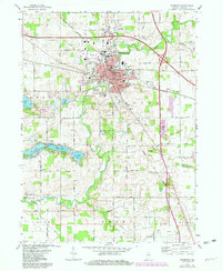
Editions of this 1972 Plymouth Map
2 editions found
Other maps of this area

1953 · Chicago
USGS Topo · 1:250,000

1957 · Chicago
USGS Topo · 1:250,000

1957 · Inwood
USGS Topo · 1:24,000

1957 · Plymouth
USGS Topo · 1:24,000

1958 · Donaldson
USGS Topo · 1:24,000

1958 · Bremen
USGS Topo · 1:24,000

1958 · La Paz
USGS Topo · 1:24,000

1958 · Walkerton
USGS Topo · 1:24,000

1962 · Argos
USGS Topo · 1:24,000

1962 · Culver
USGS Topo · 1:24,000