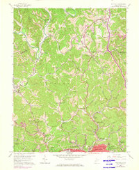
1958 Map of Pocatalico
USGS Topo · Published 1973About this map
The Pocatalico River carves a winding path through this portion of Kanawha County, defining a landscape of narrow hollows and ridge-top settlements. The 1958 topography, updated with 1971 aerial data, reveals a community structure heavily influenced by small rural schools and local churches. Educational hubs like the Active Dell Sch, Morning Star Sch, and Bonham Sch serve as neighborhood anchors alongside the Tupper Valley Gospel Tabernacle and Greenlee Chapel.
Find a feature on this map
78 named features on this map. Tap any name to fly to it.
Don’t see what you’re looking for? This feature index may not catch every label — zoom into the map to look around manually.
Map Details
Editions of this 1958 Pocatalico Map
4 editions found
Other maps of this area

1899 · Charleston
USGS Topo · 1:125,000

1906 · Kenna
USGS Topo · 1:62,500

1906 · Winfield
USGS Topo · 1:62,500

1907 · Kenna
USGS Topo · 1:62,500

1908 · Winfield
USGS Topo · 1:62,500

1909 · Charleston
USGS Topo · 1:62,500

1909 · Saint Albans
USGS Topo · 1:62,500

1931 · Saint Albans
USGS Topo · 1:62,500

1931 · Charleston
USGS Topo · 1:62,500

1933 · Saint Albans
USGS Topo · 1:62,500