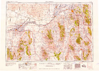
1958 Map of Pocatello
USGS Topo · Published 1958About this map
The Snake River carves a critical path through this Idaho landscape, anchoring an economy of irrigation and power evidenced by the American Falls Reservoir and Lake Walcott Reservoir. The agricultural expansion of the 1950s is visible in the network of canals like the Tyhee Lateral and the St John Ward Canal, which supported burgeoning settlements from Pocatello and Alameda to Burley. To the north, the stark terrain of the Lava beds and formations like Split Butte contrast with the industrial presence of the US Naval Ordnance Plant and the Amalgamated Radio Station.
Find a feature on this map
215 named features on this map. Tap any name to fly to it.
Don’t see what you’re looking for? This feature index may not catch every label — zoom into the map to look around manually.
Map Details
Editions of this 1958 Pocatello Map
2 editions found

Other maps of this area

1914 · Logan
USGS Topo · 1:125,000

1915 · Preston
USGS Topo · 1:96,000

1916 · Logan
USGS Topo · 1:125,000

1917 · Portneuf
USGS Topo · 1:62,500

1918 · Preston
USGS Topo · 1:125,000

1918 · Paradise Valley
USGS Topo · 1:62,500

1934 · American Falls
USGS Topo · 1:62,500

1934 · Michaud
USGS Topo · 1:62,500

1934 · Rockland
USGS Topo · 1:62,500

1936 · American Falls
USGS Topo · 1:62,500