
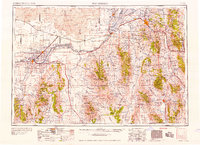
1958 Map of Pocatello
USGS Topo · Published 1958About this map
The Snake River corridor anchors this mid-century look at southeastern Idaho, where the massive American Falls Reservoir and Lake Walcott define the agricultural and industrial character of the valley. To the north, the Fort Hall Indian Reservation encompasses several thousand acres, while the Sawtooth National Forest is divided into distinct mountain blocks like the Albion Mountain Division. Local history is deeply etched into the landscape via the Old Oregon Trail, which shadows the modern transportation routes.
Find a feature on this map
158 named features on this map. Tap any name to fly to it.
Don’t see what you’re looking for? This feature index may not catch every label — zoom into the map to look around manually.
Map Details
Editions of this 1958 Pocatello Map
2 editions found
Other maps of this area

1914 · Logan
USGS Topo · 1:125,000

1915 · Preston
USGS Topo · 1:96,000

1916 · Logan
USGS Topo · 1:125,000

1917 · Portneuf
USGS Topo · 1:62,500

1918 · Preston
USGS Topo · 1:125,000

1918 · Paradise Valley
USGS Topo · 1:62,500

1934 · American Falls
USGS Topo · 1:62,500

1934 · Michaud
USGS Topo · 1:62,500

1934 · Rockland
USGS Topo · 1:62,500

1936 · American Falls
USGS Topo · 1:62,500