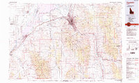
1984 Map of Pocatello
USGS Topo · Published 1984About this map
The city of Pocatello serves as a major hub where the Union Pacific Railroad meets the junction of Interstate 15 and Interstate 86, illustrating the region's role as a transportation crossroads. The landscape is defined by the expansive Fort Hall Indian Reservation and the high peaks of the Bannock Range and Deep Creek Mountains. To the west, the Snake River is impounded to form the massive American Falls Reservoir, bordering the city of American Falls. This survey documents the mid-1980s infrastructure of the area, including the growth of northern suburbs like Chubbuck and Tyhee. Cultural and recreational sites are prominent, ranging from the thermal waters at Lava Hot Springs to the riverside terrain of Massacre Rocks State Park. The map also captures several smaller farming communities and settlements such as Rockland, Aberdeen, and Arimo.
Find a feature on this map
50 named features on this map. Tap any name to fly to it.
Don’t see what you’re looking for? This feature index may not catch every label — zoom into the map to look around manually.
Map Details
Editions of this 1984 Pocatello Map
2 editions found
Other maps of this area

1915 · Preston
USGS Topo · 1:96,000

1917 · Portneuf
USGS Topo · 1:62,500

1918 · Preston
USGS Topo · 1:125,000

1918 · Paradise Valley
USGS Topo · 1:62,500

1934 · American Falls
USGS Topo · 1:62,500

1934 · Michaud
USGS Topo · 1:62,500

1934 · Rockland
USGS Topo · 1:62,500

1936 · American Falls
USGS Topo · 1:62,500

1937 · Rockland
USGS Topo · 1:62,500

1937 · Pocatello
USGS Topo · 1:48,000