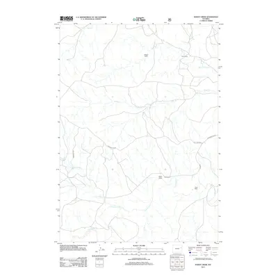
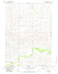
2012 Map of Poddy Creek
USGS Topo · Published 2012About this map
The Cheyenne River flows across this high-plains landscape in Weston County, defining a region where water management and ranching are central to the geography. Isolated outposts such as the Sewell Ranch and Dixon Ranch are connected by a network of rural routes including Dull Center Rd and Cheyenne River Rd, reflecting the expansive nature of modern Wyoming ranching operations. The terrain is marked by numerous seasonal drainages and named topographic depressions like School Draw and Dixon Draw, which feed into the primary arteries of Black Thunder Cr and Poddy Cr. This 2012 survey illustrates how family-named landmarks and water rights continue to shape the map of the American West, providing a clear view of the ranching infrastructure and hydrological patterns near the state's eastern border.
Find a feature on this map
14 named features on this map. Tap any name to fly to it.
Don’t see what you’re looking for? This feature index may not catch every label — zoom into the map to look around manually.
Map Details
Editions of this 2012 Poddy Creek Map
This is the sole edition of this map. No revisions or reprints were ever made.
Other maps of this area

1955 · Newcastle
USGS Topo · 1:250,000

1958 · Newcastle
USGS Topo · 1:250,000

1979 · Newcastle
USGS Topo · 1:100,000
1981 · Wagonhound Creek
USGS Topo · 1:24,000

1981 · Garland Draw
USGS Topo · 1:24,000

1981 · Wagonhound Creek NE
USGS Topo · 1:24,000

1981 · Lance Creek
USGS Topo · 1:100,000
1982 · Darlington Draw West
USGS Topo · 1:24,000
1982 · Lion Creek
USGS Topo · 1:24,000
1982 · Poddy Creek
USGS Topo · 1:24,000