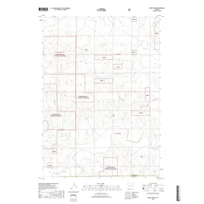
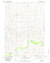
2017 Map of Poddy Creek
USGS Topo · Published 2017About this map
Thunder Basin National Grassland dominates this high plains landscape at the border of Weston and Niobrara Counties. This 2017 survey reveals a complex drainage system where the Cheyenne River winds through the southern terrain, fed by numerous ephemeral watercourses such as Horse Cr, Black Thunder Cr, and Cottonwood Cr. The topography is defined by significant erosion patterns, most notably at School Draw, Dixon Draw, and Fred Draw, illustrating the arid-land hydrology of eastern Wyoming. Transportation in this expansive grazing territory is limited to primary corridors like Dull Center Rd and Cheyenne River Rd, which navigate the township and range boundaries of t42n r67w and t41n r66w. The map serves as a precise record of public and private land parcels within the national grassland system.
Find a feature on this map
18 named features on this map. Tap any name to fly to it.
Don’t see what you’re looking for? This feature index may not catch every label — zoom into the map to look around manually.
Map Details
Editions of this 2017 Poddy Creek Map
This is the sole edition of this map. No revisions or reprints were ever made.
Other maps of this area

1955 · Newcastle
USGS Topo · 1:250,000

1958 · Newcastle
USGS Topo · 1:250,000

1979 · Newcastle
USGS Topo · 1:100,000
1981 · Wagonhound Creek
USGS Topo · 1:24,000

1981 · Garland Draw
USGS Topo · 1:24,000

1981 · Wagonhound Creek NE
USGS Topo · 1:24,000

1981 · Lance Creek
USGS Topo · 1:100,000
1982 · Darlington Draw West
USGS Topo · 1:24,000
1982 · Lion Creek
USGS Topo · 1:24,000
1982 · Poddy Creek
USGS Topo · 1:24,000