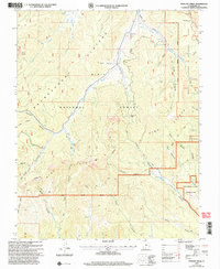
2002 Map of Podunk Creek
USGS Topo · Published 2005About this map
The Paunsaugunt Plateau forms the high geological spine of this landscape, where the headwaters of the East Fork Sevier River and Kanab Creek diverge toward different basins. This region in Kane County is defined by the sharp transition at the Pink Cliffs, where the plateau drops toward the Grand View and the complex drainage of Robinson Canyon and Swapp Canyon. The 2002 revision reflects a period of modern land management, showing the interface between the Dixie National Forest, the southern edge of Bryce Canyon National Park, and the then-recently established Grand Staircase-Escalante National Monument. Infrastructure for back-country travel and monitoring is evident at the Podunk Guard Station, the Great Western Trail, and a remote Gaging Station along the river. Numerous water sources such as Coyote Spring and Gravel Spring provide critical context for the high-desert livestock and timber heritage of the plateau.
Find a feature on this map
42 named features on this map. Tap any name to fly to it.
Don’t see what you’re looking for? This feature index may not catch every label — zoom into the map to look around manually.
Map Details
Editions of this 2002 Podunk Creek Map
This is the sole edition of this map. No revisions or reprints were ever made.
Other maps of this area

1886 · Kanab
USGS Topo · 1:250,000

1953 · Cedar City
USGS Topo · 1:250,000

1958 · Cedar City
USGS Topo · 1:250,000

1962 · Cedar City
USGS Topo · 1:250,000

1966 · Alton
USGS Topo · 1:24,000

1966 · Bald Knoll
USGS Topo · 1:24,000
1966 · Deer Spring Point
USGS Topo · 1:24,000

1966 · George Mtn
USGS Topo · 1:24,000
1966 · Podunk Creek
USGS Topo · 1:24,000
1966 · Skutumpah Creek
USGS Topo · 1:24,000