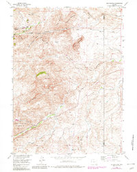
1955 Map of Poe Mountain
USGS Topo · Published 1982About this map
Sybille Game and Fish Experimental Unit occupies a significant portion of this high-altitude terrain along the western edge of the Laramie Mountains. The landscape is defined by the complex drainage network of Sybille Creek, where the North, Middle, South, and Little Sybille Creek forks converge near the Garton Sch. The map reveals a remote ranching economy at the mid-century, anchored by family-named sites like McGill Ranch near Gold Hill and Lucy Ranch to the south. Evidence of water management and early infrastructure is scattered throughout the canyons, including Dover Reservoir No 2, Grant Creek Reservoir, and an Aban'd Canal near the Albany and Platte County line. These features, along with a network of jeep trails, reflect the logistical challenges of navigating the steep elevations between Poe Mountain and Yaunt Mountain.
Find a feature on this map
32 named features on this map. Tap any name to fly to it.
Don’t see what you’re looking for? This feature index may not catch every label — zoom into the map to look around manually.
Map Details
Editions of this 1955 Poe Mountain Map
3 editions found
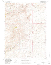
Other maps of this area

1953 · Natwick SW
USGS Topo · 1:24,000

1953 · Squaw Rock
USGS Topo · 1:24,000

1954 · Cheyenne
USGS Topo · 1:250,000

1955 · Poe Mountain
USGS Topo · 1:24,000

1955 · Moonshine Peak
USGS Topo · 1:24,000

1955 · Indian Guide
USGS Topo · 1:24,000

1955 · Guide Rock
USGS Topo · 1:24,000

1955 · Sheep Rock
USGS Topo · 1:24,000

1955 · Bull Camp Peak
USGS Topo · 1:24,000

1958 · Cheyenne
USGS Topo · 1:250,000