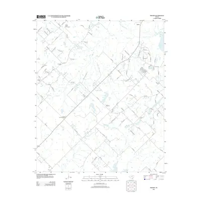
2012 Map of Poetry
USGS Topo · Published 2012About this map
Poetry and the settlement of Harris anchor this rural landscape northeast of the Dallas-Fort Worth metroplex during the early 21st century. The terrain is defined by the headwaters and tributaries of the S Fork Sabine River, including the winding paths of Greasy Cr, Muddy Cedar Cr, and Walnut Cr. To the northeast, the map shows the shoreline of Lake Tawakoni, while New Terrell City Lake sits to the south, highlighting the region's managed water resources.
Find a feature on this map
95 named features on this map. Tap any name to fly to it.
Don’t see what you’re looking for? This feature index may not catch every label — zoom into the map to look around manually.
Map Details
Editions of this 2012 Poetry Map
This is the sole edition of this map. No revisions or reprints were ever made.
Other maps of this area

1919 · Royse City
USGS Topo · 1:62,500

1954 · Dallas
USGS Topo · 1:250,000

1956 · Kaufman
USGS Topo · 1:62,500

1956 · Quinlan
USGS Topo · 1:62,500

1958 · Dallas
USGS Topo · 1:250,000

1962 · Elmo
USGS Topo · 1:24,000

1962 · Wills Point
USGS Topo · 1:24,000
1962 · Terrell North
USGS Topo · 1:24,000
1963 · Terrell South
USGS Topo · 1:24,000
1963 · Royse City
USGS Topo · 1:24,000