
1962 Map of Elmo
USGS Topo · Published 1965About this map
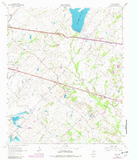
Texas and Pacific rail lines dominate the northern reaches of this Kaufman County landscape, cutting a straight path through Elmo and past the small settlement of Frog. This 1962 survey captures a rural environment in transition, most notably marked by a major highway noted as Under Construction that slices diagonally across the terrain toward College Mound. The presence of New Terrell City Lake and Old Terrell City Lake indicates a developed water management system for the nearby population centers, while smaller landmarks like Tonkersley Lake dot the interior.
Find a feature on this map
32 named features on this map. Tap any name to fly to it.
Don’t see what you’re looking for? This feature index may not catch every label — zoom into the map to look around manually.
Map Details
Editions of this 1962 Elmo Map
2 editions found
Other maps of this area

1919 · Royse City
USGS Topo · 1:62,500

1954 · Dallas
USGS Topo · 1:250,000

1956 · Kaufman
USGS Topo · 1:62,500

1956 · Quinlan
USGS Topo · 1:62,500

1958 · Dallas
USGS Topo · 1:250,000

1962 · Cedarvale
USGS Topo · 1:24,000

1962 · Wills Point
USGS Topo · 1:24,000
1962 · Ola
USGS Topo · 1:24,000
1962 · Terrell North
USGS Topo · 1:24,000
1963 · Terrell South
USGS Topo · 1:24,000