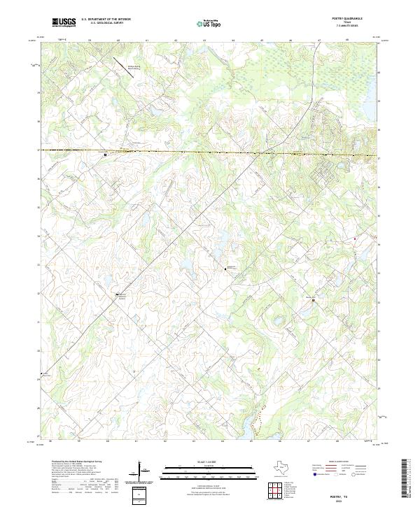
2022 Map of Poetry
USGS Topo · Published 2022About this map
The Hunt Co Kaufman Co boundary line bisects this landscape of meandering creek beds and rural cemeteries. Much of the northeast corner is dominated by the S Fork Sabine River as it opens into Kitsee Inlet, surrounded by a dense network of country roads including Pecan Valley Rd and Newell Creek Dr. This area maintains a distinctively rural character, where local landmarks are defined by long-established family and community burial grounds such as Camp Ground Cem and Henderson Mosley Cem.
Find a feature on this map
82 named features on this map. Tap any name to fly to it.
Don’t see what you’re looking for? This feature index may not catch every label — zoom into the map to look around manually.
Map Details
Editions of this 2022 Poetry Map
This is the sole edition of this map. No revisions or reprints were ever made.
Other maps of this area

1919 · Royse City
USGS Topo · 1:62,500

1954 · Dallas
USGS Topo · 1:250,000

1956 · Kaufman
USGS Topo · 1:62,500

1956 · Quinlan
USGS Topo · 1:62,500

1958 · Dallas
USGS Topo · 1:250,000

1962 · Elmo
USGS Topo · 1:24,000

1962 · Wills Point
USGS Topo · 1:24,000
1962 · Terrell North
USGS Topo · 1:24,000
1963 · Terrell South
USGS Topo · 1:24,000
1963 · Royse City
USGS Topo · 1:24,000