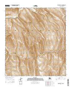
2014 Map of Point Hope B-1 NE
USGS Topo · Published 2014About this map
Ipewik River winds through the northern reaches of this remote Alaskan landscape, creating the primary topographical relief in an area defined by its severe, high-latitude terrain. This U.S. Geological Survey topographic study from 2014 focuses on the unpopulated wilderness within the Alaska-North Slope Borough. The map captures the complex drainage patterns and elevation contours of the Arctic tundra, centered on the t11s r57w and t11s r56w townships. The absence of human infrastructure, roads, or named settlements highlights the preserved natural state of this region, providing a baseline for environmental researchers and those studying the remote geography of the American North.
Find a feature on this map
5 named features on this map. Tap any name to fly to it.
Don’t see what you’re looking for? This feature index may not catch every label — zoom into the map to look around manually.
Map Details
Editions of this 2014 Point Hope B-1 NE Map
This is the sole edition of this map. No revisions or reprints were ever made.
Other maps of this area

1951 · De Long Mountains
USGS Topo · 1:250,000

1952 · Point Hope
USGS Topo · 1:250,000

1955 · De Long Mountains
USGS Topo · 1:250,000

1955 · Point Hope
USGS Topo · 1:250,000

1955 · Point Hope C-1
USGS Topo · 1:63,360

1955 · Point Hope B-1
USGS Topo · 1:63,360

1955 · De Long Mountains C-5
USGS Topo · 1:63,360
1955 · De Long Mountains B-5
USGS Topo · 1:63,360

1965 · Point Hope
USGS Topo · 1:250,000

1965 · De Long Mountains
USGS Topo · 1:250,000