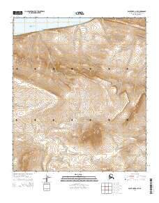
2014 Map of Point Hope D-1 SE
USGS Topo · Published 2014About this map
The Chukchi Sea coastline defines the northern edge of this remote Arctic landscape, where steep coastal bluffs quickly give way to a complex system of drainage basins and prominent interior elevations. Kitkonak Hill and North Aluk Hill serve as significant topographic landmarks, anchoring a terrain dominated by the branching headwaters of several drainages. The hydrology of the North Slope is well-documented here, showing the winding paths of Sakvelak Cr and Nigiktlik Cr as they cut through the tundra. The southern portion of the map is defined by the Nilik River, illustrating the characteristic braided or meandering water patterns of the region. This 2014 survey captures the undisturbed character of the landscape, providing an essential record for studying the natural geography of the region before potential environmental shifts or industrial changes affect these coastal and inland features.
Find a feature on this map
15 named features on this map. Tap any name to fly to it.
Don’t see what you’re looking for? This feature index may not catch every label — zoom into the map to look around manually.
Map Details
Editions of this 2014 Point Hope D-1 SE Map
This is the sole edition of this map. No revisions or reprints were ever made.
Other maps of this area

1951 · De Long Mountains
USGS Topo · 1:250,000

1952 · Point Hope
USGS Topo · 1:250,000

1952 · Point Hope D-1
USGS Topo · 1:63,360

1955 · De Long Mountains
USGS Topo · 1:250,000

1955 · Point Hope
USGS Topo · 1:250,000

1955 · Point Hope C-1
USGS Topo · 1:63,360

1955 · De Long Mountains C-5
USGS Topo · 1:63,360
1955 · De Long Mountains D-5
USGS Topo · 1:63,360

1965 · Point Hope
USGS Topo · 1:250,000

1965 · De Long Mountains
USGS Topo · 1:250,000