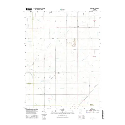
2016 Map of Point Isabel
USGS Topo · Published 2016About this map
Swayzee and Point Isabel anchor this survey of the central Indiana countryside, where the borders of Grant, Howard, Tipton, and Madison counties converge. The landscape is defined by an extensive system of agricultural drainage, including Wimmer Ditch, Keaton Ditch, and Sims-Franklin Ditch, which redirect water into larger channels like Pipe Cr and Wildcat Cr. Small crossroads communities such as Normal and Rigdon punctuate the grid of county roads, showing the persistent settlement patterns of the region's farming heritage. For genealogists, the Alel Cem near Cole provides a specific point of interest. The area's transport history is visible in the alignment of the S Strawtown Pike, a route that cuts diagonally across the standard township and range section lines near the Madison County line.
Find a feature on this map
51 named features on this map. Tap any name to fly to it.
Don’t see what you’re looking for? This feature index may not catch every label — zoom into the map to look around manually.
Map Details
Editions of this 2016 Point Isabel Map
This is the sole edition of this map. No revisions or reprints were ever made.
Other maps of this area

1953 · Muncie
USGS Topo · 1:250,000

1956 · Muncie
USGS Topo · 1:250,000

1960 · Elwood
USGS Topo · 1:24,000

1960 · Point Isabel
USGS Topo · 1:24,000

1960 · Alexandria
USGS Topo · 1:24,000

1960 · Fairmount
USGS Topo · 1:24,000

1960 · Windfall
USGS Topo · 1:24,000

1960 · Greentown
USGS Topo · 1:24,000

1961 · Marion
USGS Topo · 1:24,000
1962 · Amboy
USGS Topo · 1:24,000